
Paypay:AmundsenSea.jpg
Kadako hin nga pahiuna nga pagawas: 800 × 566 nga mga pixel. Iba nga mga resolusyon: 320 × 226 nga mga pixel | 640 × 452 nga mga pixel | 1,024 × 724 nga mga pixel | 1,280 × 905 nga mga pixel | 2,808 × 1,985 nga mga pixel.
Orihinal nga paypay (2,808 × 1,985 nga pixel, kadako han fayl: 1.12 nga MB, MIME nga tipo: image/jpeg)
Dalikyat nga pulong
| Tigtulidong |
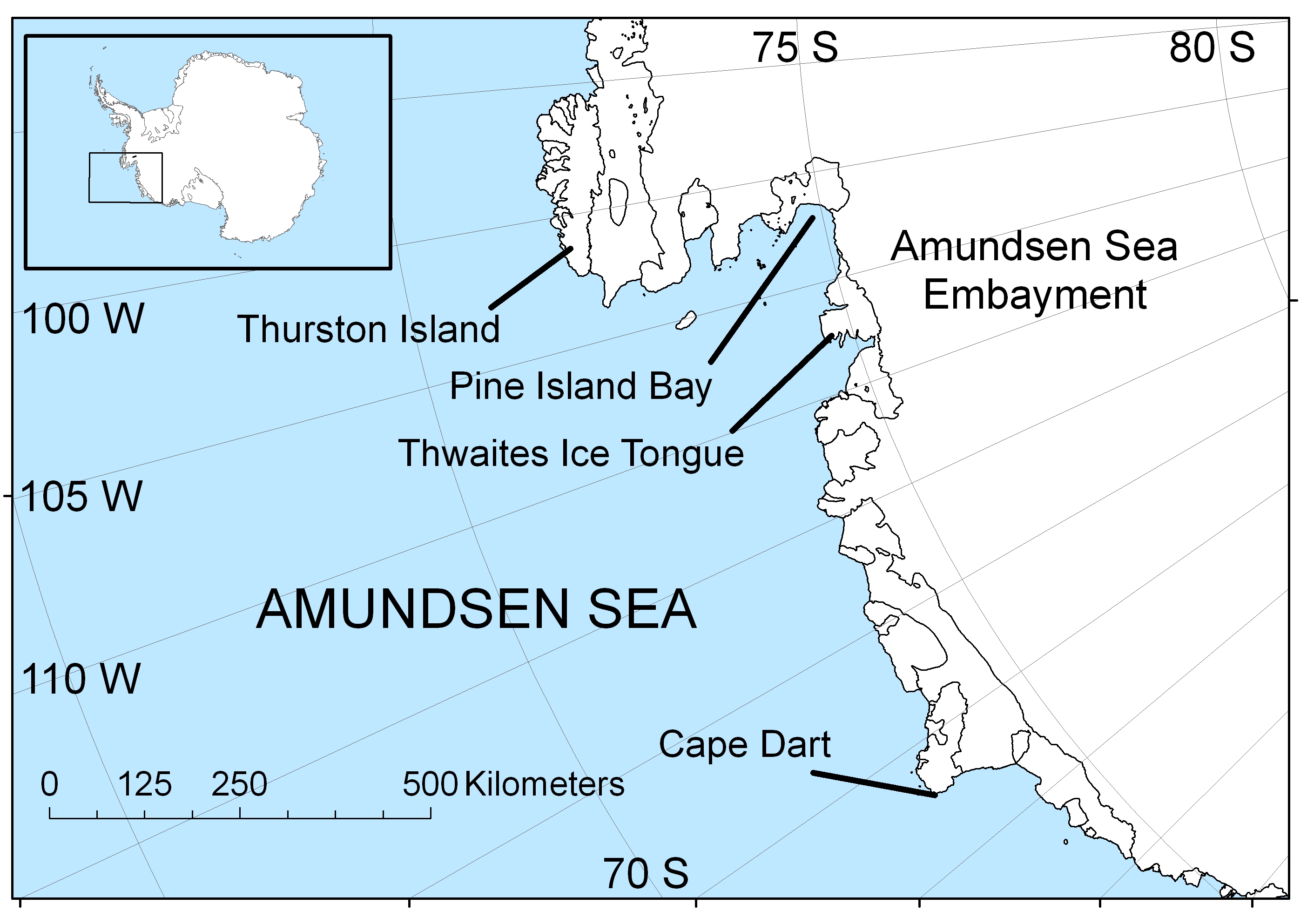
English: Map of the Amundsen Sea area of Antarctica |
| Petsa | |
| Ginkuhaan | Kalugaringon nga buhat |
| Awtor | Polargeo |
| Other versions | العربيَّة |
Palilisensya:
| I, the copyright holder of this work, release this work into the public domain. This applies worldwide. In some countries this may not be legally possible; if so: I grant anyone the right to use this work for any purpose, without any conditions, unless such conditions are required by law. |
Kaagi han paypay
Pidlita an adlaw/oras para makit-an an fayl nga naggawas hito nga oras.
| Pitsa/Oras | Thumbnail | Mga dimensyon | Gumaramit | Komento | |
|---|---|---|---|---|---|
| waray pa kasasapawi | 16:22, 30 Abril 2009 | | 2,808 × 1,985 (1.12 nga MB) | Polargeo | {{Information |Description={{en|1=Map of the Amundsen Sea area of Antarctica}} |Source=Own work by uploader |Author=Polargeo |Date=2009-04-30 |Permission= |other_versions= }} <!--{{ImageUpload|full}}--> |
Mga Sumpay
An mga nasunod nga mga pakli nasumpay hini nga paypay:
Global file usage
An masunod nga iba nga mga wiki in nagamit hini nga file:
- Paggamit ha af.wikipedia.org
- Paggamit ha ar.wikipedia.org
- Paggamit ha arz.wikipedia.org
- Paggamit ha ast.wikipedia.org
- Paggamit ha az.wikipedia.org
- Paggamit ha bs.wikipedia.org
- Paggamit ha ca.wikipedia.org
- Paggamit ha cs.wikipedia.org
- Paggamit ha cy.wikipedia.org
- Paggamit ha da.wikipedia.org
- Paggamit ha de.wikipedia.org
- Paggamit ha en.wikipedia.org
- Paggamit ha eo.wikipedia.org
- Paggamit ha es.wikipedia.org
- Paggamit ha eu.wikipedia.org
- Paggamit ha fa.wikipedia.org
- Paggamit ha fi.wikipedia.org
- Paggamit ha fr.wikipedia.org
- Paggamit ha fy.wikipedia.org
- Paggamit ha gl.wikipedia.org
- Paggamit ha he.wikipedia.org
- Paggamit ha hu.wikipedia.org
- Paggamit ha hy.wikipedia.org
- Paggamit ha hyw.wikipedia.org
- Paggamit ha id.wikipedia.org
- Paggamit ha ilo.wikipedia.org
- Paggamit ha is.wikipedia.org
- Paggamit ha ja.wikipedia.org
- Paggamit ha ko.wikipedia.org
- Paggamit ha la.wikipedia.org
- Paggamit ha lt.wikipedia.org
- Paggamit ha mk.wikipedia.org
- Paggamit ha ml.wikipedia.org
- Paggamit ha ms.wikipedia.org
- Paggamit ha nl.wikipedia.org
- Paggamit ha nn.wikipedia.org
- Paggamit ha pa.wikipedia.org
- Paggamit ha pl.wikipedia.org
- Paggamit ha pnb.wikipedia.org
- Paggamit ha pt.wikipedia.org
- Paggamit ha simple.wikipedia.org
- Paggamit ha sr.wikipedia.org
Kitaa durudamo nga global usage hinin nga file.