
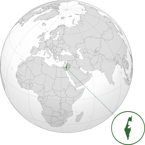
Paypay:ISR orthographic.svg

Size of this PNG preview of this SVG file: 600 × 600 nga mga pixel. Iba nga mga resolusyon: 240 × 240 nga mga pixel | 480 × 480 nga mga pixel | 768 × 768 nga mga pixel | 1,024 × 1,024 nga mga pixel | 2,048 × 2,048 nga mga pixel.
Orihinal nga paypay (SVG nga fayl, ginbabanabanahan nga 600 × 600 nga mga pixel, kadako han fayl: 1.39 nga MB)
Dalikyat nga pulong
| Tigtulidong | |
| Petsa | |
| Ginkuhaan |
Kalugaringon nga buhat with Natural Earth Data This W3C-unspecified vector image was created with Inkscape . |
| Awtor | Addicted04 |
Palilisensya:
I, the copyright holder of this work, hereby publish it under the following license:
Ini nga file in nakalisensya ha ilarom han Creative Commons Attribution-Share Alike 3.0 Unported license.
- Talwas ka:
- para han pagpasaro – para han pagkopya, pagpakalat ngan pagpadangat han buhat
- para han pagremix – pag-adapt han buhat
- Ha ilarom an masunod nga mga kondisyon:
- attribution – Kinahanglanon mo tagan hin kaangayan nga credit, paghatag hin sumpay ngadto ha lisensya, ngan igbutang an imo ginbag-ohan nga binuhat. Puydi mo ini buhaton ha bisan ano nga resonable nga pamaagi, pero diri nimo pagawson nga an naghatag hin lisensya nag-eendorso ha imo o ha imo paggamit.
- share alike – Kun imo ginsagol-hin-otro, gin-iba, o gin-hingayad han buhat, ikaw in angay gud là magpakalat han imo gin-amot ha ilarom la han [http:creativecommons.org/share-your-work/licensing-considerations/compatible-licenses pareho o naangay nga lisensya] sugad han orihinal.
Kaagi han paypay
Pidlita an adlaw/oras para makit-an an fayl nga naggawas hito nga oras.
| Pitsa/Oras | Thumbnail | Mga dimensyon | Gumaramit | Komento | |
|---|---|---|---|---|---|
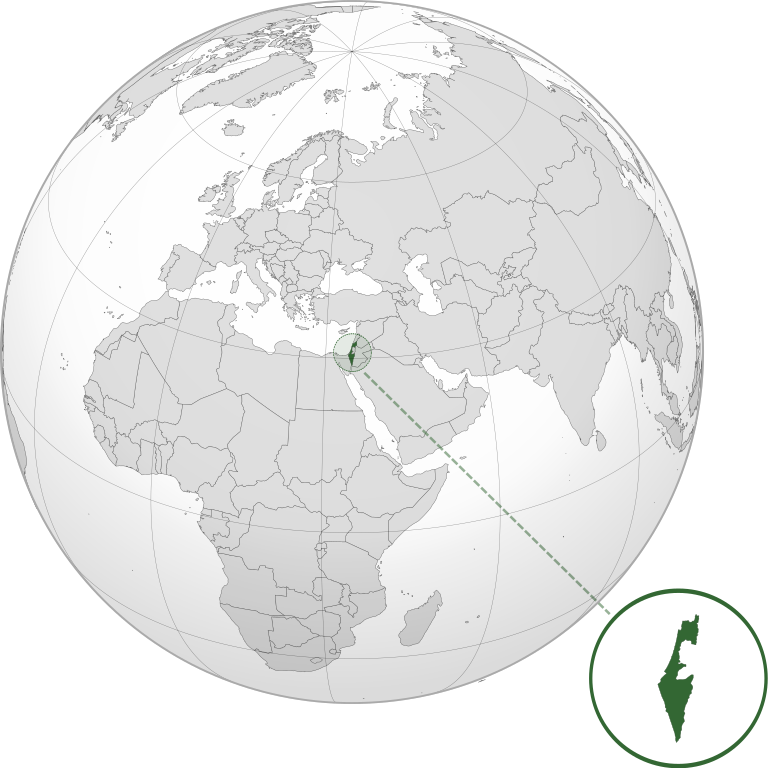
| waray pa kasasapawi | 03:46, 17 Marso 2022 | | 600 × 600 (1.39 nga MB) | Chaddy | Reverted to version as of 06:27, 24 March 2019 (UTC), there is already another map for the disputed borders: File:Israel (orthographic projection) with disputed territories.svg |
| 09:48, 10 Marso 2022 |  | 600 × 600 (1.4 nga MB) | Beshogur | Reverted to version as of 06:25, 24 March 2019 (UTC) | |
| 06:27, 24 Marso 2019 |  | 600 × 600 (1.39 nga MB) | BlueHypercane761 | Reverted to version as of 22:09, 21 September 2016 (UTC) Self-revert. As legitimate as this revision is, I will split it off into a new image file. | |
| 06:25, 24 Marso 2019 |  | 600 × 600 (1.4 nga MB) | BlueHypercane761 | Restoring previous revision temporarily to retrieve image. | |
| 22:09, 21 Septyembre 2016 |  | 600 × 600 (1.39 nga MB) | Nableezy | make a new map, this one is fine | |
| 18:50, 16 Septyembre 2016 |  | 600 × 600 (1.4 nga MB) | Bolter21 | added disputed territories | |
| 03:06, 8 Hulyo 2012 |  | 600 × 600 (1.39 nga MB) | Addicted04 | America land | |
| 02:42, 8 Hulyo 2012 |  | 600 × 600 (1.39 nga MB) | Addicted04 |
_with_disputed_territories.svg)
Mga Sumpay
An mga nasunod nga mga pakli nasumpay hini nga paypay:
Global file usage
An masunod nga iba nga mga wiki in nagamit hini nga file:
- Paggamit ha af.wikipedia.org
- Paggamit ha am.wikipedia.org
- Paggamit ha arc.wikipedia.org
- Paggamit ha av.wikipedia.org
- Paggamit ha ay.wikipedia.org
- Paggamit ha azb.wikipedia.org
- Paggamit ha az.wiktionary.org
- Paggamit ha ban.wikipedia.org
- Paggamit ha bbc.wikipedia.org
- Paggamit ha bcl.wikipedia.org
- Paggamit ha bg.wikipedia.org
- Paggamit ha bh.wikipedia.org
- Paggamit ha bi.wikipedia.org
- Paggamit ha bn.wikipedia.org
- Paggamit ha bs.wikipedia.org
- Paggamit ha bxr.wikipedia.org
- Paggamit ha cdo.wikipedia.org
- Paggamit ha ceb.wikipedia.org
- Paggamit ha chr.wikipedia.org
- Paggamit ha ckb.wikipedia.org
- Paggamit ha cs.wikipedia.org
- Paggamit ha da.wikipedia.org
- Paggamit ha dty.wikipedia.org
- Paggamit ha en.wikipedia.org
- Paggamit ha en.wikibooks.org
- Paggamit ha es.wikipedia.org
- Paggamit ha eu.wikipedia.org
- Paggamit ha fi.wikipedia.org
- Paggamit ha fr.wikipedia.org
- Paggamit ha gn.wikipedia.org
- Paggamit ha gu.wikipedia.org
- Paggamit ha gv.wikipedia.org
- Paggamit ha hak.wikipedia.org
- Paggamit ha hr.wikipedia.org
- Paggamit ha hy.wikipedia.org
- Paggamit ha id.wikipedia.org
- Paggamit ha ie.wikipedia.org
- Paggamit ha incubator.wikimedia.org
Kitaa durudamo nga global usage hinin nga file.