
Paypay:Ilex vomitoria range map.jpg
Kadako hin nga pahiuna nga pagawas: 475 × 599 nga mga pixel. Iba nga mga resolusyon: 190 × 240 nga mga pixel | 380 × 480 nga mga pixel | 609 × 768 nga mga pixel | 1,085 × 1,369 nga mga pixel.
Orihinal nga paypay (1,085 × 1,369 nga pixel, kadako han fayl: 281 nga KB, MIME nga tipo: image/jpeg)
Dalikyat nga pulong
| Tigtulidong |
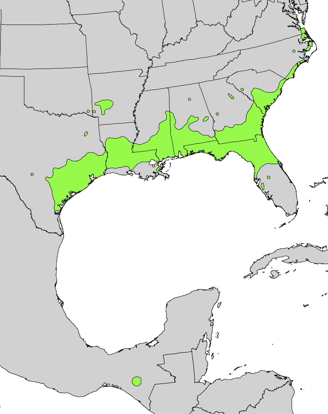
English: Range distribution map of Ilex vomitoria in eastern North America. |
| Petsa | |
| Ginkuhaan | Digital representation of "Atlas of United States Trees" by Elbert L. Little, Jr. [1] |
| Awtor | U.S. Geological Survey |


Palilisensya:
This image is in the public domain in the United States because it only contains materials that originally came from the United States Geological Survey, an agency of the United States Department of the Interior. For more information, see the official USGS copyright policy.
|
Original upload log
Transferred from en.wikipedia to Commons by Pinethicket using CommonsHelper.
The original description page was here. All following user names refer to en.wikipedia.
- 2012-10-01 17:43 Pinethicket 1085×1369× (438574 bytes) {{Information |Description=Range map of ''Ilex vomitoria'' |Source=Digital representation of "Atlas of United States Trees" by Elbert L. Little, Jr. [http://esp.cr.usgs.gov/data/atlas/little/] |Date=1999 |Author=U.S. Geological Survey |Pe...
Kaagi han paypay
Pidlita an adlaw/oras para makit-an an fayl nga naggawas hito nga oras.
| Pitsa/Oras | Thumbnail | Mga dimensyon | Gumaramit | Komento | |
|---|---|---|---|---|---|
| waray pa kasasapawi | 03:00, 8 Enero 2017 | | 1,085 × 1,369 (281 nga KB) | Quibik | remove vertical stripes |
| 22:26, 14 Oktubre 2012 |  | 1,085 × 1,369 (428 nga KB) | File Upload Bot (Magnus Manske) | Transfered from en.wikipedia by User:Pinethicket using CommonsHelper |
Mga Sumpay
An mga nasunod nga mga pakli nasumpay hini nga paypay:
Global file usage
An masunod nga iba nga mga wiki in nagamit hini nga file:
- Paggamit ha arz.wikipedia.org
- Paggamit ha ca.wikipedia.org
- Paggamit ha ceb.wikipedia.org
- Paggamit ha de.wikipedia.org
- Paggamit ha en.wikipedia.org
- Paggamit ha species.wikimedia.org
- Paggamit ha sv.wikipedia.org
- Paggamit ha tr.wikipedia.org
- Paggamit ha uk.wikipedia.org
- Paggamit ha vi.wikipedia.org
- Paggamit ha www.wikidata.org
- Paggamit ha zh.wikipedia.org