
Paypay:Ireland location map.svg

Size of this PNG preview of this SVG file: 481 × 599 nga mga pixel. Iba nga mga resolusyon: 192 × 240 nga mga pixel | 385 × 480 nga mga pixel | 616 × 768 nga mga pixel | 822 × 1,024 nga mga pixel | 1,643 × 2,048 nga mga pixel | 1,450 × 1,807 nga mga pixel.
Orihinal nga paypay (SVG nga fayl, ginbabanabanahan nga 1,450 × 1,807 nga mga pixel, kadako han fayl: 938 nga KB)
Dalikyat nga pulong
| Tigtulidong |
Deutsch: Positionskarte von Irland
Quadratische Plattkarte, N-S-Streckung 170 %. Geographische Begrenzung der Karte:
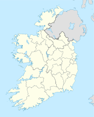
English: Location map of Ireland
Equirectangular projection, N/S stretching 170 %. Geographic limits of the map:
|
| Petsa | 01-07-2008 |
| Ginkuhaan | own work, using United States National Imagery and Mapping Agency data |
| Awtor | NordNordWest |
| Other versions |
DerivativeVersions |


|
This map has been made or improved in the German Kartenwerkstatt (Map Lab). You can propose maps to improve as well.
|
Palilisensya:
I, the copyright holder of this work, hereby publish it under the following licenses:

|
An permiso in ginhatag ha pagkopya, pagpakalat ngan/o pagliwat hinin nga dokumento ha ilarom han mga termino han GNU Free Documentation License, Version 1.2 o mas uruurhi nga version nga ginmantala han Free Software Foundation; nga may-ada waray Invariant Sections, waray Front-Cover Texts, ngan waray Back-Cover Texts. May-ada kopya hin lisensya nga ginlalakip ha seksyon nga may-ada pamagat nga GNU Free Documentation License. |
Ini nga file in nakalisensya ha ilarom han Creative Commons Attribution-Share Alike 3.0 Unported license.
- Talwas ka:
- para han pagpasaro – para han pagkopya, pagpakalat ngan pagpadangat han buhat
- para han pagremix – pag-adapt han buhat
- Ha ilarom an masunod nga mga kondisyon:
- attribution – Kinahanglanon mo tagan hin kaangayan nga credit, paghatag hin sumpay ngadto ha lisensya, ngan igbutang an imo ginbag-ohan nga binuhat. Puydi mo ini buhaton ha bisan ano nga resonable nga pamaagi, pero diri nimo pagawson nga an naghatag hin lisensya nag-eendorso ha imo o ha imo paggamit.
- share alike – Kun imo ginsagol-hin-otro, gin-iba, o gin-hingayad han buhat, ikaw in angay gud là magpakalat han imo gin-amot ha ilarom la han [http:creativecommons.org/share-your-work/licensing-considerations/compatible-licenses pareho o naangay nga lisensya] sugad han orihinal.
Puydi ka pumili hin lisenysa nga karuyag mo.
Kaagi han paypay
Pidlita an adlaw/oras para makit-an an fayl nga naggawas hito nga oras.
| Pitsa/Oras | Thumbnail | Mga dimensyon | Gumaramit | Komento | |
|---|---|---|---|---|---|
| waray pa kasasapawi | 06:45, 18 Hulyo 2020 | | 1,450 × 1,807 (938 nga KB) | Chipmunkdavis | Adding toggle to display pre-2014 boundaries, adjusting some code for names and shape |
| 06:47, 11 Hulyo 2020 |  | 1,450 × 1,807 (908 nga KB) | Chipmunkdavis | Overhauling code, together with code from File:Galway City in Ireland.svg (itself derived from this file), to be both simpler and more easily editable. All islands are now grouped with their mainland county, and counties are grouped into provinces. Groups exist for traditional counties where divided. | |
| 12:08, 12 Septyembre 2014 |  | 1,450 × 1,807 (597 nga KB) | Ravenpuff | Retry that | |
| 11:57, 12 Septyembre 2014 |  | 1,450 × 1,807 (597 nga KB) | Ravenpuff | Merged North Tipperary and South Tiperrary, Limerick and County Limerick, Waterford and County Waterford (Local Government Reform Act 2014) | |
| 18:04, 1 Septyembre 2009 |  | 1,450 × 1,807 (598 nga KB) | NordNordWest | ||
| 19:08, 25 Agosto 2008 |  | 1,450 × 1,807 (599 nga KB) | NordNordWest | size correction | |
| 18:13, 19 Hulyo 2008 |  | 483 × 602 (581 nga KB) | NordNordWest | ||
| 14:13, 1 Hulyo 2008 |  | 483 × 602 (554 nga KB) | NordNordWest | {{Information |Description= {{de|Positionskarte von Irland}} Quadratische Plattkarte, N-S-Streckung 170 %. Geographische Begrenzung der Karte: * N: 55.6° N * S: 51.2° N * W: 11.0° W * O: 5.0° W {{en|Location map of [[:en:Ireland|Ireland |
Mga Sumpay
An mga nasunod nga mga pakli nasumpay hini nga paypay:
Global file usage
An masunod nga iba nga mga wiki in nagamit hini nga file:
- Paggamit ha af.wikipedia.org
- Paggamit ha am.wikipedia.org
- Paggamit ha ar.wikipedia.org
- Paggamit ha arz.wikipedia.org
- Paggamit ha ba.wikipedia.org
- Paggamit ha be-tarask.wikipedia.org
- Paggamit ha be.wikipedia.org
- Paggamit ha bg.wikipedia.org
Kitaa durudamo nga global usage hinin nga file.