
Paypay:Ireland relief location map.png
Kadako hin nga pahiuna nga pagawas: 481 × 599 nga mga pixel. Iba nga mga resolusyon: 192 × 240 nga mga pixel | 385 × 480 nga mga pixel | 616 × 768 nga mga pixel | 822 × 1,024 nga mga pixel | 1,450 × 1,807 nga mga pixel.
Orihinal nga paypay (1,450 × 1,807 nga pixel, kadako han fayl: 1.55 nga MB, MIME nga tipo: image/png)
| Tigtulidong |
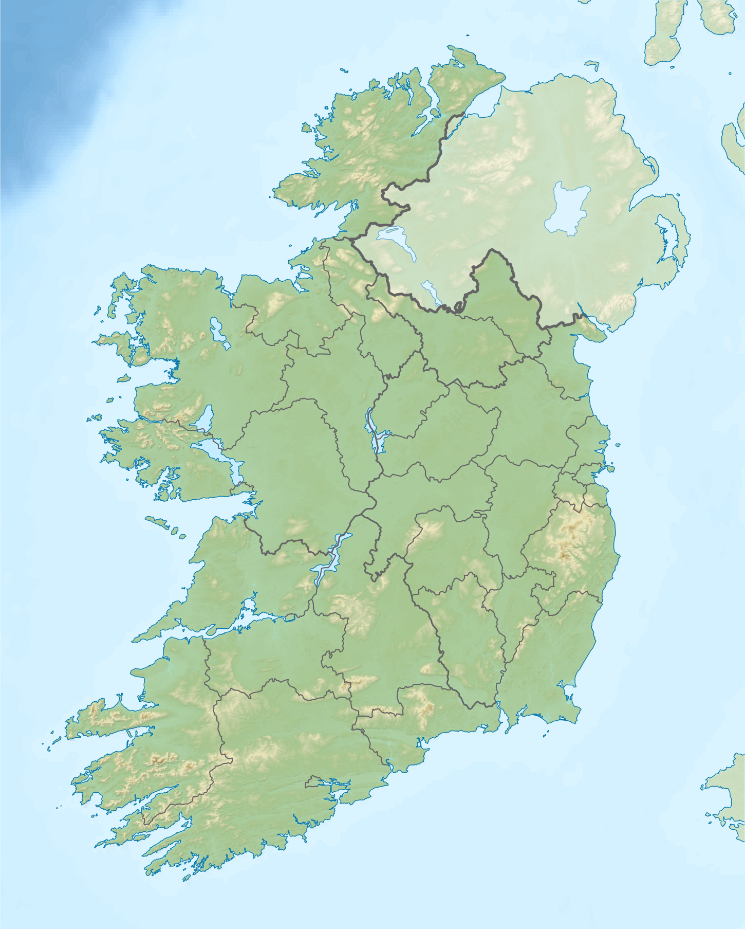
Relief location map of Ireland Equirectangular map projection on WGS 84 datum, with N/S stretched 170% Geographic limits:
|
| Petsa | |
| Ginkuhaan |
Shuttle Radar Topography Mission
National Geospatial-Intelligence Agency
File:Ireland location map.svg: NordNordWest
|
| Awtor | Nilfanion |
| Pagtugot (Gin-uutro paggamit inin nga file) |
Ini nga file in nakalisensya ha ilarom han Creative Commons Attribution-Share Alike 3.0 Unported license.
|
| Other versions |
.png)

Kaagi han paypay
Pidlita an adlaw/oras para makit-an an fayl nga naggawas hito nga oras.
| Pitsa/Oras | Thumbnail | Mga dimensyon | Gumaramit | Komento | |
|---|---|---|---|---|---|
| waray pa kasasapawi | 08:32, 24 Agosto 2020 | | 1,450 × 1,807 (1.55 nga MB) | Jacobfrid | Reverted to version as of 12:29, 12 September 2014 (UTC) |
| 12:17, 23 Agosto 2020 |  | 324 × 280 (90 nga KB) | Jacobfrid | Cropped 78 % horizontally, 85 % vertically using CropTool with precise mode. | |
| 12:29, 12 Septyembre 2014 |  | 1,450 × 1,807 (1.55 nga MB) | NordNordWest | Local Government Reform Act 2014 | |
| 00:02, 23 Oktubre 2012 |  | 1,450 × 1,807 (1.56 nga MB) | Nilfanion | Fix UK shading nr Londonderry | |
| 22:43, 15 Abril 2012 |  | 1,450 × 1,807 (1.56 nga MB) | Nilfanion | {{Information |Description=Relief map of Ireland Equirectangular map projection on WGS 84 datum, with N/S stretched 170% Geographic limits: *West: 11.0° W *East: 5.0° W *North: 55.6° N *South: 51.2° N |Source= [[w:Shuttle Radar Topo... |
Mga Sumpay
An mga nasunod nga mga pakli nasumpay hini nga paypay:
Global file usage
An masunod nga iba nga mga wiki in nagamit hini nga file:
- Paggamit ha als.wikipedia.org
- Paggamit ha am.wikipedia.org
- Paggamit ha ar.wikipedia.org
- Paggamit ha ast.wikipedia.org
- Paggamit ha azb.wikipedia.org
- Paggamit ha ban.wikipedia.org
- Paggamit ha ba.wikipedia.org
- Paggamit ha be-tarask.wikipedia.org
- Paggamit ha bn.wikipedia.org
- Paggamit ha br.wikipedia.org
- Paggamit ha bs.wikipedia.org
- Paggamit ha bxr.wikipedia.org
- Paggamit ha ca.wikipedia.org
- Paggamit ha ceb.wikipedia.org
- Paggamit ha cs.wikipedia.org
- Paggamit ha cv.wikipedia.org
Kitaa durudamo nga global usage hinin nga file.