
Paypay:Actinote zikani distribution map.svg

Size of this PNG preview of this SVG file: 557 × 599 nga mga pixel. Iba nga mga resolusyon: 223 × 240 nga mga pixel | 446 × 480 nga mga pixel | 714 × 768 nga mga pixel | 952 × 1,024 nga mga pixel | 1,903 × 2,048 nga mga pixel | 1,051 × 1,131 nga mga pixel.
Orihinal nga paypay (SVG nga fayl, ginbabanabanahan nga 1,051 × 1,131 nga mga pixel, kadako han fayl: 1.17 nga MB)
Dalikyat nga pulong
| Tigtulidong |
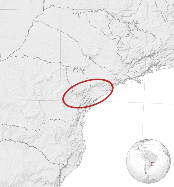
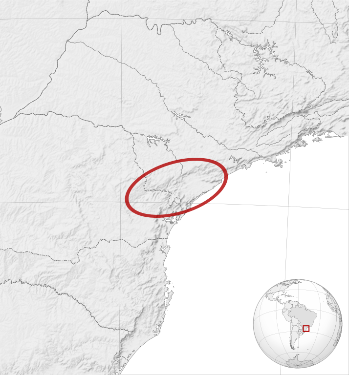
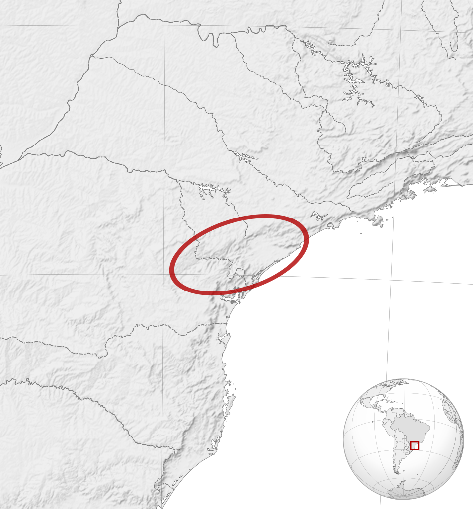
English: Actinote zikani distribution map. Cartographic data :
Français : Aire de répartition du papillon Actinote zikani. Données cartographiques :
|
| Petsa | |
| Ginkuhaan |
English:
Français : |
| Awtor |
|
| Other versions | |
| Attribution (required by the license) | © Sémhur / Wikimedia Commons / |
| SVG genesis |
.svg)
| Camera location | | View this and other nearby images on: OpenStreetMap |
|---|
Palilisensya:
I, the copyright holder of this work, hereby publish it under the following licenses:
| Copyleft: This work of art is free; you can redistribute it and/or modify it according to terms of the Free Art License. You will find a specimen of this license on the Copyleft Attitude site as well as on other sites. |
This file is licensed under the Creative Commons Attribution-Share Alike 4.0 International, 3.0 Unported, 2.5 Generic, 2.0 Generic and 1.0 Generic license.
- Talwas ka:
- para han pagpasaro – para han pagkopya, pagpakalat ngan pagpadangat han buhat
- para han pagremix – pag-adapt han buhat
- Ha ilarom an masunod nga mga kondisyon:
- attribution – Kinahanglanon mo tagan hin kaangayan nga credit, paghatag hin sumpay ngadto ha lisensya, ngan igbutang an imo ginbag-ohan nga binuhat. Puydi mo ini buhaton ha bisan ano nga resonable nga pamaagi, pero diri nimo pagawson nga an naghatag hin lisensya nag-eendorso ha imo o ha imo paggamit.
- share alike – Kun imo ginsagol-hin-otro, gin-iba, o gin-hingayad han buhat, ikaw in angay gud là magpakalat han imo gin-amot ha ilarom la han [http:creativecommons.org/share-your-work/licensing-considerations/compatible-licenses pareho o naangay nga lisensya] sugad han orihinal.
Puydi ka pumili hin lisenysa nga karuyag mo.
Kaagi han paypay
Pidlita an adlaw/oras para makit-an an fayl nga naggawas hito nga oras.
| Pitsa/Oras | Thumbnail | Mga dimensyon | Gumaramit | Komento | |
|---|---|---|---|---|---|
| waray pa kasasapawi | 19:35, 24 Abril 2014 | | 1,051 × 1,131 (1.17 nga MB) | Sémhur | Valid SVG |
| 11:59, 8 Oktubre 2012 |  | 1,051 × 1,131 (1.28 nga MB) | Sémhur | good size | |
| 11:53, 8 Oktubre 2012 |  | 512 × 551 (1.29 nga MB) | Sémhur | == {{int:filedesc}} == {{Information |Description={{Multilingual description |en= en:Actinote zikani distribution map.<br> Cartographic data : * Lambert azimuthal equal-area projection * Limits of the map : N -19.5, W -53.5, S -29.5, E -43.5 |fr=... |
Mga Sumpay
An mga nasunod nga mga pakli nasumpay hini nga paypay:
Global file usage
An masunod nga iba nga mga wiki in nagamit hini nga file:
- Paggamit ha be.wikipedia.org
- Paggamit ha ceb.wikipedia.org
- Paggamit ha fr.wikipedia.org
- Paggamit ha pt.wikipedia.org
- Paggamit ha ru.wikipedia.org
- Paggamit ha sv.wikipedia.org
- Paggamit ha vi.wikipedia.org
- Paggamit ha www.wikidata.org