
Paypay:Alicante-loc.svg

Size of this PNG preview of this SVG file: 593 × 599 nga mga pixel. Iba nga mga resolusyon: 237 × 240 nga mga pixel | 475 × 480 nga mga pixel | 760 × 768 nga mga pixel | 1,013 × 1,024 nga mga pixel | 2,026 × 2,048 nga mga pixel | 2,134 × 2,157 nga mga pixel.
Orihinal nga paypay (SVG nga fayl, ginbabanabanahan nga 2,134 × 2,157 nga mga pixel, kadako han fayl: 275 nga KB)
Dalikyat nga pulong
| Tigtulidong |
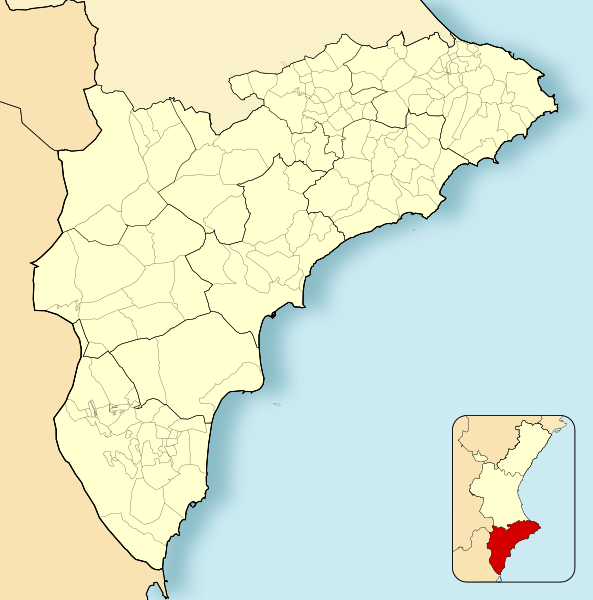
English: Location map of Province of Alicante
Equirectangular projection, N/S stretching 130 %. Geographic limits of the map:
Español: Mapa de localización de la Provincia de Alicante
Proyección equirrectangular (cilíndrica equidistante), N/S estirada 130 %. Límites geográficos del mapa:
|
|
| Petsa | ||
| Ginkuhaan | Own work based on: EspañaLoc.svg | |
| Awtor | Miguillen | |
| SVG genesis | This locator map was created with Adobe Illustrator, and with Inkscape.
|
Palilisensya:
Miguillen, the copyright holder of this work, hereby publishes it under the following license:
Ini nga file in nakalisensya ha ilarom han Creative Commons Attribution-Share Alike 3.0 Unported license.
Attribution: Miguillen
- Talwas ka:
- para han pagpasaro – para han pagkopya, pagpakalat ngan pagpadangat han buhat
- para han pagremix – pag-adapt han buhat
- Ha ilarom an masunod nga mga kondisyon:
- attribution – Kinahanglanon mo tagan hin kaangayan nga credit, paghatag hin sumpay ngadto ha lisensya, ngan igbutang an imo ginbag-ohan nga binuhat. Puydi mo ini buhaton ha bisan ano nga resonable nga pamaagi, pero diri nimo pagawson nga an naghatag hin lisensya nag-eendorso ha imo o ha imo paggamit.
- share alike – Kun imo ginsagol-hin-otro, gin-iba, o gin-hingayad han buhat, ikaw in angay gud là magpakalat han imo gin-amot ha ilarom la han [http:creativecommons.org/share-your-work/licensing-considerations/compatible-licenses pareho o naangay nga lisensya] sugad han orihinal.
Kaagi han paypay
Pidlita an adlaw/oras para makit-an an fayl nga naggawas hito nga oras.
| Pitsa/Oras | Thumbnail | Mga dimensyon | Gumaramit | Komento | |
|---|---|---|---|---|---|
| waray pa kasasapawi | 15:46, 8 Disyembre 2010 | | 2,134 × 2,157 (275 nga KB) | Miguillen | colores |
| 16:58, 16 Nobyembre 2010 |  | 2,134 × 2,157 (216 nga KB) | Miguillen | == {{int:filedesc}} == {{Information |Description={{en|Location map of Province of Alicante}} Equirectangular projection, N/S stretching 130 %. Geographic limits of the map: * N: ° N * S: ° N * W: ° O * E: ° E {{es|M |
Mga Sumpay
An mga nasunod nga mga pakli nasumpay hini nga paypay:
Global file usage
An masunod nga iba nga mga wiki in nagamit hini nga file:
- Paggamit ha ar.wikipedia.org
- Paggamit ha ast.wikipedia.org
- Paggamit ha ba.wikipedia.org
- Paggamit ha ceb.wikipedia.org
- Paggamit ha en.wikipedia.org
- Elche
- Guardamar del Segura
- Xàbia
- Altea
- Novelda
- Villena
- Santa Pola
- Calpe
- Ibi, Spain
- Cocentaina
- Benejúzar
- Muro de Alcoy
- Pinoso
- Pilar de la Horadada
- La Vall de Gallinera
- Moraira
- Lucentum
- Villamartin
- Benissa
- Teulada, Spain
- Lorcha, Spain
- Jalón
- Bigastro
- Callosa de Segura
- San Miguel de Salinas
- Agost
- Busot
- Gorga, Spain
- Mutxamel
- Salinas, Alicante
- Sax, Alicante
- Pedreguer
- 1992 UCI Road World Championships
- Module:Location map/data/Spain Province of Alicante/doc
- University of Orihuela
- Lycée Français d'Alicante
- Camino de Beniel
- Module:Location map/data/Spain Province of Alicante
- Barbarroja (Alicante)
- La Murada
- 2022 Segunda División RFEF play-offs
- Paggamit ha eo.wikipedia.org
Kitaa durudamo nga global usage hinin nga file.