
Paypay:Atlantic Ocean laea location map.svg

Size of this PNG preview of this SVG file: 491 × 599 nga mga pixel. Iba nga mga resolusyon: 197 × 240 nga mga pixel | 393 × 480 nga mga pixel | 629 × 768 nga mga pixel | 839 × 1,024 nga mga pixel | 1,679 × 2,048 nga mga pixel | 709 × 865 nga mga pixel.
Orihinal nga paypay (SVG nga fayl, ginbabanabanahan nga 709 × 865 nga mga pixel, kadako han fayl: 274 nga KB)
Dalikyat nga pulong
| Tigtulidong |
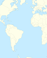
English: Relief location map of Atlantic_Ocean.
|
| Petsa | |
| Ginkuhaan | Kalugaringon nga buhat |
| Awtor | Tentotwo |
Shell script for generating the map using GMT archive copy at the Wayback Machine
#!/bin/sh

# Set common options
PROJECTION=A-35.0/0.0/180/19.998266666666666c
REGION=-147.58842045747764/-48.58942183011819/77.58842045747762/48.589421830118205r
FILENAME=Atlantic_Ocean_laea_location_map.ps

# Get Natural Earth datafiles
echo "Downloading datafiles from naturalearthdata.com"
wget -nv -nc \
 http://www.naturalearthdata.com/http//www.naturalearthdata.com/download/110m/physical/110m-coastline.zip\
 http://www.naturalearthdata.com/http//www.naturalearthdata.com/download/110m/physical/110m-land.zip\
 http://www.naturalearthdata.com/http//www.naturalearthdata.com/download/110m/cultural/110m-admin-0-boundary-lines.zip
echo "...done\n"

echo "Inflating archives"
unzip 110m\*.zip
echo "...done\n"

echo "Converting shapefiles to GMT"
ogr2ogr -F GMT 110m_land.gmt 110m_land.shp
ogr2ogr -F GMT 110m_coastline.gmt 110m_coastline.shp
ogr2ogr -F GMT 110m_borders.gmt ne_110m_admin_0_boundary_lines_land.shp
echo "...done\n"

echo "Creating maps"
GMT psxy -m -J$PROJECTION -R$REGION -Bg15 -P --PAGE_COLOR=198/236/255  --POLAR_CAP=none --BASEMAP_TYPE=plain --BASEMAP_AXES=NESW --FRAME_PEN=0.15p,black 110m_land.gmt -K -G254/254/233 > $FILENAME
GMT psxy -m -J$PROJECTION -R$REGION 110m_coastline.gmt -O -K -W0.535p,9/120/171  >> $FILENAME
GMT psxy -m -J$PROJECTION -R$REGION 110m_borders.gmt -O -W100/100/100  >> $FILENAME
echo "...done\n"

echo "You can now open $FILENAME in Inkscape to clean up the file and save it as SVG. You should add an ocean coloured background and simplify the graticules using CTRL+L."

gv $FILENAME
Palilisensya:
I, the copyright holder of this work, hereby publish it under the following license:
Ini nga file in nakalisensya ha ilarom han Creative Commons Attribution-Share Alike 3.0 Unported license.
- Talwas ka:
- para han pagpasaro – para han pagkopya, pagpakalat ngan pagpadangat han buhat
- para han pagremix – pag-adapt han buhat
- Ha ilarom an masunod nga mga kondisyon:
- attribution – Kinahanglanon mo tagan hin kaangayan nga credit, paghatag hin sumpay ngadto ha lisensya, ngan igbutang an imo ginbag-ohan nga binuhat. Puydi mo ini buhaton ha bisan ano nga resonable nga pamaagi, pero diri nimo pagawson nga an naghatag hin lisensya nag-eendorso ha imo o ha imo paggamit.
- share alike – Kun imo ginsagol-hin-otro, gin-iba, o gin-hingayad han buhat, ikaw in angay gud là magpakalat han imo gin-amot ha ilarom la han [http:creativecommons.org/share-your-work/licensing-considerations/compatible-licenses pareho o naangay nga lisensya] sugad han orihinal.
Kaagi han paypay
Pidlita an adlaw/oras para makit-an an fayl nga naggawas hito nga oras.
| Pitsa/Oras | Thumbnail | Mga dimensyon | Gumaramit | Komento | |
|---|---|---|---|---|---|
| waray pa kasasapawi | 21:19, 31 Enero 2012 | | 709 × 865 (274 nga KB) | Tentotwo | Corrected colour of black sea |
| 21:17, 31 Enero 2012 |  | 709 × 865 (298 nga KB) | Tentotwo | Included border of South Sudan | |
| 13:38, 31 Enero 2012 |  | 709 × 865 (248 nga KB) | Tentotwo | Removed grid line | |
| 13:36, 31 Enero 2012 |  | 709 × 865 (239 nga KB) | Tentotwo |
Mga Sumpay
An mga nasunod nga mga pakli nasumpay hini nga paypay:
Global file usage
An masunod nga iba nga mga wiki in nagamit hini nga file:
- Paggamit ha af.wikipedia.org
- Paggamit ha als.wikipedia.org
- Paggamit ha ar.wikipedia.org
- Paggamit ha ast.wikipedia.org
- Paggamit ha azb.wikipedia.org
- Paggamit ha be-tarask.wikipedia.org
- Paggamit ha be.wikipedia.org
- Paggamit ha ceb.wikipedia.org
- Plantilya:Location map Atlantic Ocean
- South Point
- Scotts Hill
- Saddle Hill
- The Ridge
- Pillar Rock
- James Bay
- Castle Hill
- Bird Island
- North Point
- West Point
- Sandy Point
- Black Point
- Powell Point
- Black Rock
- Egg Island
- East Point
- White Rock
- White Point
- Whale Point
- Long Point
- The Bluff
- Middle Point
- Crown Point
- Channel Rock
- Cave Point
- Blue Hill
- South West Point
- White Bluff
- Sandy Bay
- George Island
Kitaa durudamo nga global usage hinin nga file.