
Paypay:Backenswarft, Hallig Hooge, Germany.jpg
Kadako hin nga pahiuna nga pagawas: 800 × 425 nga mga pixel. Iba nga mga resolusyon: 320 × 170 nga mga pixel | 640 × 340 nga mga pixel | 1,024 × 544 nga mga pixel | 1,280 × 680 nga mga pixel | 2,738 × 1,455 nga mga pixel.
Orihinal nga paypay (2,738 × 1,455 nga pixel, kadako han fayl: 3.22 nga MB, MIME nga tipo: image/jpeg)
Dalikyat nga pulong
| Tigtulidong |
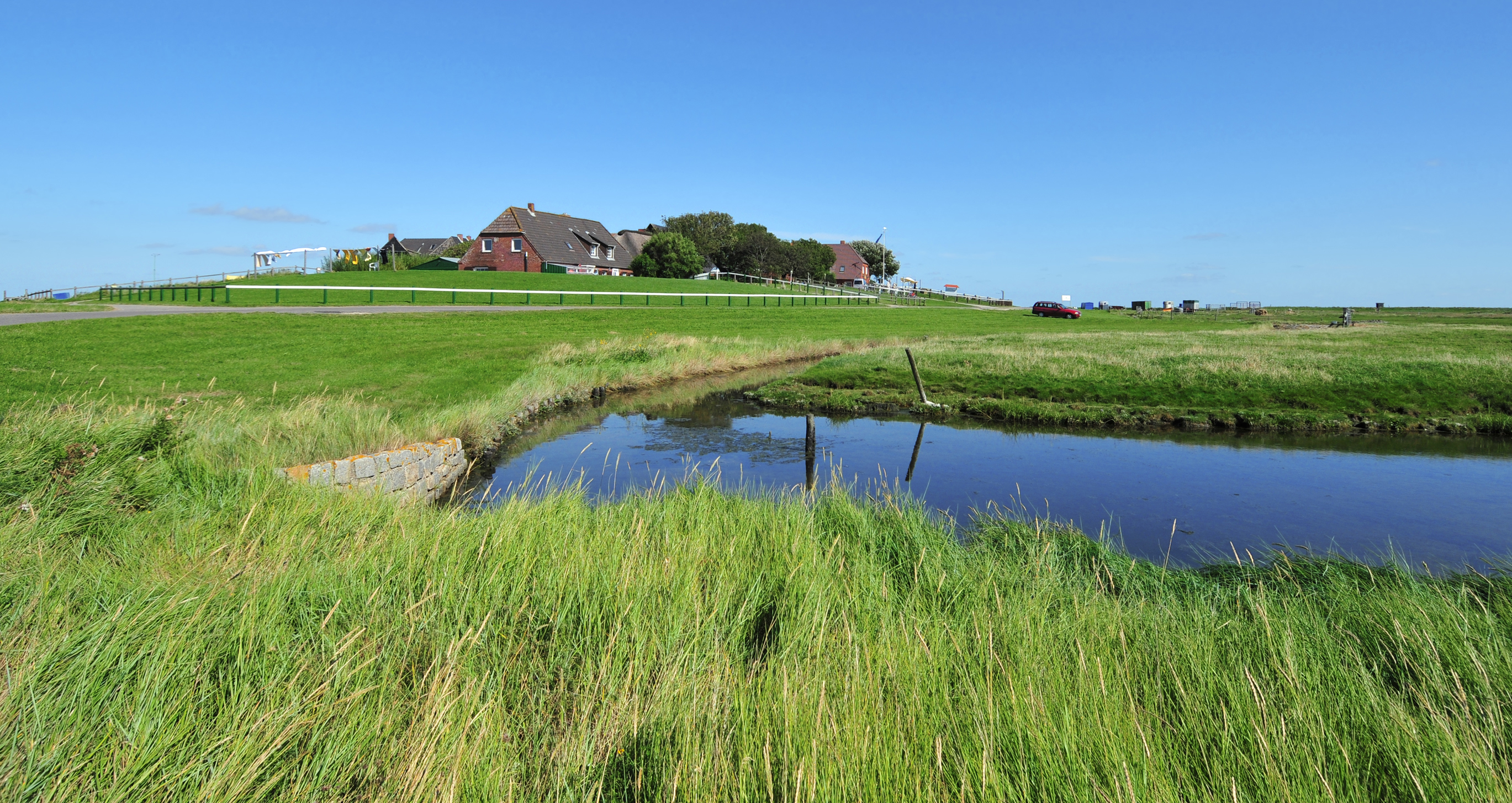
Deutsch: Blick auf die Backenswarft. Sie steht auf der Hallig Hooge. Die Hallig Hooge ist die zweitgrößte der zehn Halligen im Schleswig-Holsteinischen Wattenmeer. Hallig Hooge ist von einem rund 1,20 Meter hohen Steindeich umgeben und ist dadurch bei leichten Sturmfluten vor Landunter geschützt. Dennoch wird die Hallig Hooge zwei bis fünf Mal im Jahr vollständig überflutet. Die Wohnhäuser stehen auf hohen Warften, damit sie den Sturmfluten widerstehen können. Die Hallig Hooge besitzt zwölf Warften. Die Backenswarft ist die zweitgrößte Warft mit einem Dutzend Gebäuden, die ringförmig den Fething mit Regenwasser umschließen und vor Salzwasser schützen.
English: View to the Backenswarft on Hallig Hooge. The Hallig Hooge is the second largest of the ten islets in the Schleswig-Holstein Wadden Sea. Hallig Hooge is surrounded by an approximately 1.20 meters high stone dyke and is thus protected from light storm surges. Nevertheless Hallig Hooge is flooded completely two to five times a year. The Houses are built on high mounds. Therefore they can withstand the storm surges. The Hallig Hooge has twelve mounds. The Backenswarft is the second largest mound with a dozen buildings. The buildings surround the pond with rainwater. |
| Petsa | Taken on 27 Agosto 2012 |
| Ginkuhaan | Kalugaringon nga buhat |
| Awtor | Michael Gäbler |
| Camera location | | View this and other nearby images on: OpenStreetMap |
|---|
Palilisensya:
Michael Gäbler, the copyright holder of this work, hereby publishes it under the following license:
This file is licensed under the Creative Commons Attribution 3.0 Unported license.
Attribution: Michael Gäbler
- Talwas ka:
- para han pagpasaro – para han pagkopya, pagpakalat ngan pagpadangat han buhat
- para han pagremix – pag-adapt han buhat
- Ha ilarom an masunod nga mga kondisyon:
- attribution – Kinahanglanon mo tagan hin kaangayan nga credit, paghatag hin sumpay ngadto ha lisensya, ngan igbutang an imo ginbag-ohan nga binuhat. Puydi mo ini buhaton ha bisan ano nga resonable nga pamaagi, pero diri nimo pagawson nga an naghatag hin lisensya nag-eendorso ha imo o ha imo paggamit.
Assessment
|
Kaagi han paypay
Pidlita an adlaw/oras para makit-an an fayl nga naggawas hito nga oras.
| Pitsa/Oras | Thumbnail | Mga dimensyon | Gumaramit | Komento | |
|---|---|---|---|---|---|
| waray pa kasasapawi | 19:55, 23 Septyembre 2012 | | 2,738 × 1,455 (3.22 nga MB) | Michael Gäbler | {{Information |Description= {{de|1= Blick auf die Backenswarft. Sie steht auf der Hallig Hooge. Die Hallig Hooge ist die zweitgrößte der zehn Halligen in dem [[:de:Nationalpark Schleswig-Holstei... |
Mga Sumpay
An mga nasunod nga mga pakli nasumpay hini nga paypay:
Global file usage
An masunod nga iba nga mga wiki in nagamit hini nga file:
- Paggamit ha ace.wikipedia.org
- Paggamit ha ca.wikipedia.org
- Paggamit ha da.wikipedia.org
- Paggamit ha de.wikipedia.org
- Paggamit ha en.wikipedia.org
- Paggamit ha eo.wikipedia.org
- Paggamit ha ka.wikipedia.org
- Paggamit ha mk.wikipedia.org
- Paggamit ha nl.wikipedia.org
- Paggamit ha pt.wikipedia.org
- Paggamit ha ro.wikipedia.org
- Paggamit ha ru.wikipedia.org
- Paggamit ha sv.wikipedia.org