
Paypay:Bavaria relief location map.jpg

Kadako hin nga pahiuna nga pagawas: 608 × 600 nga mga pixel. Iba nga mga resolusyon: 243 × 240 nga mga pixel | 487 × 480 nga mga pixel | 779 × 768 nga mga pixel | 1,038 × 1,024 nga mga pixel | 1,695 × 1,672 nga mga pixel.
Orihinal nga paypay (1,695 × 1,672 nga pixel, kadako han fayl: 1.14 nga MB, MIME nga tipo: image/jpeg)
Dalikyat nga pulong
| Tigtulidong |
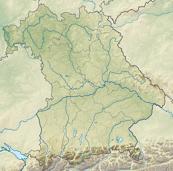
Deutsch: Physische Positionskarte Bayern, Deutschland. Geographische Begrenzung der Karte:
English: Physical Location map Bavaria, Germany. Geographic limits of the map:
|
| Petsa | |
| Ginkuhaan |
Kalugaringon nga buhat |
| Awtor | Grundkarte TUBS, Relief Alexrk2 |
| Other versions |
|

Palilisensya:
I, the copyright holder of this work, hereby publish it under the following licenses:

|
An permiso in ginhatag ha pagkopya, pagpakalat ngan/o pagliwat hinin nga dokumento ha ilarom han mga termino han GNU Free Documentation License, Version 1.2 o mas uruurhi nga version nga ginmantala han Free Software Foundation; nga may-ada waray Invariant Sections, waray Front-Cover Texts, ngan waray Back-Cover Texts. May-ada kopya hin lisensya nga ginlalakip ha seksyon nga may-ada pamagat nga GNU Free Documentation License. |
This file is licensed under the Creative Commons Attribution-Share Alike 3.0 Unported, 2.5 Generic, 2.0 Generic and 1.0 Generic license.
- Talwas ka:
- para han pagpasaro – para han pagkopya, pagpakalat ngan pagpadangat han buhat
- para han pagremix – pag-adapt han buhat
- Ha ilarom an masunod nga mga kondisyon:
- attribution – Kinahanglanon mo tagan hin kaangayan nga credit, paghatag hin sumpay ngadto ha lisensya, ngan igbutang an imo ginbag-ohan nga binuhat. Puydi mo ini buhaton ha bisan ano nga resonable nga pamaagi, pero diri nimo pagawson nga an naghatag hin lisensya nag-eendorso ha imo o ha imo paggamit.
- share alike – Kun imo ginsagol-hin-otro, gin-iba, o gin-hingayad han buhat, ikaw in angay gud là magpakalat han imo gin-amot ha ilarom la han [http:creativecommons.org/share-your-work/licensing-considerations/compatible-licenses pareho o naangay nga lisensya] sugad han orihinal.
Puydi ka pumili hin lisenysa nga karuyag mo.
Kaagi han paypay
Pidlita an adlaw/oras para makit-an an fayl nga naggawas hito nga oras.
| Pitsa/Oras | Thumbnail | Mga dimensyon | Gumaramit | Komento | |
|---|---|---|---|---|---|
| waray pa kasasapawi | 12:17, 19 Nobyembre 2009 | | 1,695 × 1,672 (1.14 nga MB) | Alexrk2 | == {{int:filedesc}} == {{Information |Description= {{de|Physische Positionskarte Bayern, Deutschland. Geographische Begrenzung der Karte:}} {{en|Physical Location map Bavaria, Germany. Geographic limits of the map:}} * N: |
Mga Sumpay
An mga nasunod nga mga pakli nasumpay hini nga paypay:
Global file usage
An masunod nga iba nga mga wiki in nagamit hini nga file:
- Paggamit ha als.wikipedia.org
- Paggamit ha an.wikipedia.org
- Chiemsee
- Tüttensee
- Río Traun (Bavera)
- Rote Traun
- Hochfelln
- Hochgern
- Achental (Bavera)
- Watzmann
- Waginger See
- Río Itz
- Königssee
- Ammersee
- Río Ammer
- Laco de Starnberg
- Eibsee
- Tegernsee (laco)
- Pilsensee
- Wörthsee (laco)
- Weßlinger See
- Feringasee
- Walchensee
- Egglburger See
- Lacos de Seeon
- Unterschleißheimer See
- Unterföhringer See
- Zugspitze
- Kochelsee
- Hoher Peißenberg
- Sylvensteinspeicher
- Río Würm
- Großer Brombachsee
- Schliersee (laco)
- Spitzingsee
- Wendelstein
- Altmühlsee
- Glaciar de Blaueis
- Río Lech
- Paggamit ha ar.wikipedia.org
- Paggamit ha ast.wikipedia.org
Kitaa durudamo nga global usage hinin nga file.