
Paypay:Berkshire UK location map.svg

Size of this PNG preview of this SVG file: 800 × 416 nga mga pixel. Iba nga mga resolusyon: 320 × 166 nga mga pixel | 640 × 333 nga mga pixel | 1,024 × 532 nga mga pixel | 1,280 × 666 nga mga pixel | 2,560 × 1,331 nga mga pixel | 1,425 × 741 nga mga pixel.
Orihinal nga paypay (SVG nga fayl, ginbabanabanahan nga 1,425 × 741 nga mga pixel, kadako han fayl: 1.51 nga MB)
| Tigtulidong |
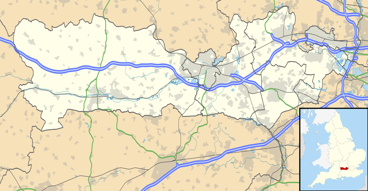
Map of Berkshire, UK with the following information shown:
Equirectangular map projection on WGS 84 datum, with N/S stretched 160% Geographic limits:
|
| Petsa | |
| Ginkuhaan |
|
| Awtor | Nilfanion, created using Ordnance Survey data |
| Pagtugot (Gin-uutro paggamit inin nga file) |
Ini nga file in nakalisensya ha ilarom han Creative Commons Attribution-Share Alike 3.0 Unported license. Attribution: Contains Ordnance Survey data © Crown copyright and database right
|
| Other versions | File:Berkshire UK district map (blank).svg - Blank map |
.svg)
Kaagi han paypay
Pidlita an adlaw/oras para makit-an an fayl nga naggawas hito nga oras.
| Pitsa/Oras | Thumbnail | Mga dimensyon | Gumaramit | Komento | |
|---|---|---|---|---|---|
| waray pa kasasapawi | 17:56, 26 Septyembre 2010 | | 1,425 × 741 (1.51 nga MB) | Nilfanion | {{Information |Description=Map of Berkshire, UK with the following information shown: *Administrative borders *Coastline, lakes and rivers *Roads and railways *Urban areas Equirectangular map projection on WGS 84 datum, with N/S stretched |
Mga Sumpay
An mga nasunod nga mga pakli nasumpay hini nga paypay:
Global file usage
An masunod nga iba nga mga wiki in nagamit hini nga file:
- Paggamit ha ar.wikipedia.org
- Paggamit ha azb.wikipedia.org
- Paggamit ha bg.wikipedia.org
- Paggamit ha bn.wikipedia.org
- Paggamit ha ceb.wikipedia.org
- Paggamit ha en.wikipedia.org
- Slough
- Newbury, Berkshire
- Britwell
- Chalvey
- Colnbrook
- Langley, Berkshire
- Upton, Slough
- Speen, Berkshire
- Maidenhead
- Sandhurst, Berkshire
- Bracknell
- Wraysbury
- Datchet
- Hungerford
- Windsor, Berkshire
- Caversham, Reading
- Frogmore
- Eton, Berkshire
- Ditton, Slough
- Horton, Berkshire
- Sunningdale
- Earley
- Hurley, Berkshire
Kitaa durudamo nga global usage hinin nga file.