
Paypay:Blank map of xmao-geoloc.svg

Size of this PNG preview of this SVG file: 512 × 323 nga mga pixel. Iba nga mga resolusyon: 320 × 202 nga mga pixel | 640 × 404 nga mga pixel | 1,024 × 646 nga mga pixel | 1,280 × 808 nga mga pixel | 2,560 × 1,615 nga mga pixel.
Orihinal nga paypay (SVG nga fayl, ginbabanabanahan nga 512 × 323 nga mga pixel, kadako han fayl: 155 nga KB)
Dalikyat nga pulong
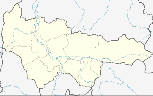
| Tigtulidong | Geolocation map for Khnaty-Mansi's Autonomous District of Yugra (Russia) |
| Petsa | |
| Ginkuhaan | Own Draw |
| Awtor | WWay, Deviritative work from Khanty-Mansiysky AO.png by СафроновАВ (Russian Wikipedia) |
| Other versions |
Derivative works of this file: |
Palilisensya:
I, the copyright holder of this work, hereby publish it under the following license:
Ini nga file in nakalisensya ha ilarom han Creative Commons Attribution-Share Alike 3.0 Unported license.
- Talwas ka:
- para han pagpasaro – para han pagkopya, pagpakalat ngan pagpadangat han buhat
- para han pagremix – pag-adapt han buhat
- Ha ilarom an masunod nga mga kondisyon:
- attribution – Kinahanglanon mo tagan hin kaangayan nga credit, paghatag hin sumpay ngadto ha lisensya, ngan igbutang an imo ginbag-ohan nga binuhat. Puydi mo ini buhaton ha bisan ano nga resonable nga pamaagi, pero diri nimo pagawson nga an naghatag hin lisensya nag-eendorso ha imo o ha imo paggamit.
- share alike – Kun imo ginsagol-hin-otro, gin-iba, o gin-hingayad han buhat, ikaw in angay gud là magpakalat han imo gin-amot ha ilarom la han [http:creativecommons.org/share-your-work/licensing-considerations/compatible-licenses pareho o naangay nga lisensya] sugad han orihinal.
Kaagi han paypay
Pidlita an adlaw/oras para makit-an an fayl nga naggawas hito nga oras.
| Pitsa/Oras | Thumbnail | Mga dimensyon | Gumaramit | Komento | |
|---|---|---|---|---|---|
| waray pa kasasapawi | 21:03, 29 Nobyembre 2010 | | 512 × 323 (155 nga KB) | Виктор В | Обрезка по координатам, стандартные цвета, дополнения на основе naturalearthdata.com |
| 01:26, 8 Septyembre 2010 |  | 500 × 300 (8 nga KB) | Orange-kun | Code reduced | |
| 17:02, 9 Marso 2010 |  | 560 × 325 (23 nga KB) | Orange-kun | Reverted to version as of 20:39, 5 March 2010 Khanty-Mansia is the independent subject of Russia. Even trough it connects to Tyumen Oblast, we use geoloc for the subjects. | |
| 23:01, 5 Marso 2010 |  | 1,030 × 661 (82 nga KB) | Пакко | corr | |
| 22:50, 5 Marso 2010 |  | 1,030 × 661 (82 nga KB) | Пакко | better version | |
| 20:39, 5 Marso 2010 |  | 560 × 325 (23 nga KB) | Iguacu | standart colours | |
| 17:17, 24 Septyembre 2009 |  | 560 × 325 (21 nga KB) | Orange-kun | {{Information |Description= Geolocation map for Khnaty-Mansi's Autonomous District of Yugra (Russia) |Source=Own Draw |Date=24\09\09 |Author=WWay |Permission= |other_versions= }} |
Mga Sumpay
An mga nasunod nga mga pakli nasumpay hini nga paypay:
Global file usage
An masunod nga iba nga mga wiki in nagamit hini nga file:
- Paggamit ha af.wikipedia.org
- Paggamit ha ar.wikipedia.org
- Paggamit ha azb.wikipedia.org
- Paggamit ha ba.wikipedia.org
- Ҡалып:ПозКарта Рәсәй Ханты-Манси автономиялы округы — Югра
- Ортъягун (Хант-Манси автономиялы округы — Югра)
- Верхнеказымский
- Ванзеват
- Нумто
- Казым (Хант-Манси автономиялы округы — Югра)
- Лыхма
- Пашторы
- Сосновка (Белоярский районы)
- Юильск
- Деминская
- Тутлейм
- Шайтанка (ауыл)
- Анеева
- Ванзетур
- Новинская
- Нерохи
- Усть-Манья
- Приполярный
- Хурумпауль
- Щекурья
- Ясунт
- Светлый (Хант-Манси автономиялы округы)
- Сосьва (Хант-Манси автономиялы округы)
- Верхненильдина
- Кимкьясуй
- Ломбовож
- Патрасуй
- Теги (ҡасаба)
- Пугоры
- Устрём
- Елушкино (Кондинское районы)
- Алтай (Кондинское районы)
- Болчары
- Дальний (Кондинское районы)
- Ильичёвка
- Кама (Кондинское районы)
- Катыш (Кондинское районы)
- Леуши
- Леушинка
- Лиственичный (Кондинское районы)
- Мулымья
- Назарово (Кондинское районы)
- Никулкина
- Сатыга
- Сотник (Кондинское районы)
Kitaa durudamo nga global usage hinin nga file.