
Paypay:Caerphilly UK relief location map.jpg
Kadako hin nga pahiuna nga pagawas: 423 × 599 nga mga pixel. Iba nga mga resolusyon: 169 × 240 nga mga pixel | 339 × 480 nga mga pixel | 542 × 768 nga mga pixel | 723 × 1,024 nga mga pixel | 1,998 × 2,830 nga mga pixel.
Orihinal nga paypay (1,998 × 2,830 nga pixel, kadako han fayl: 561 nga KB, MIME nga tipo: image/jpeg)
| Tigtulidong |
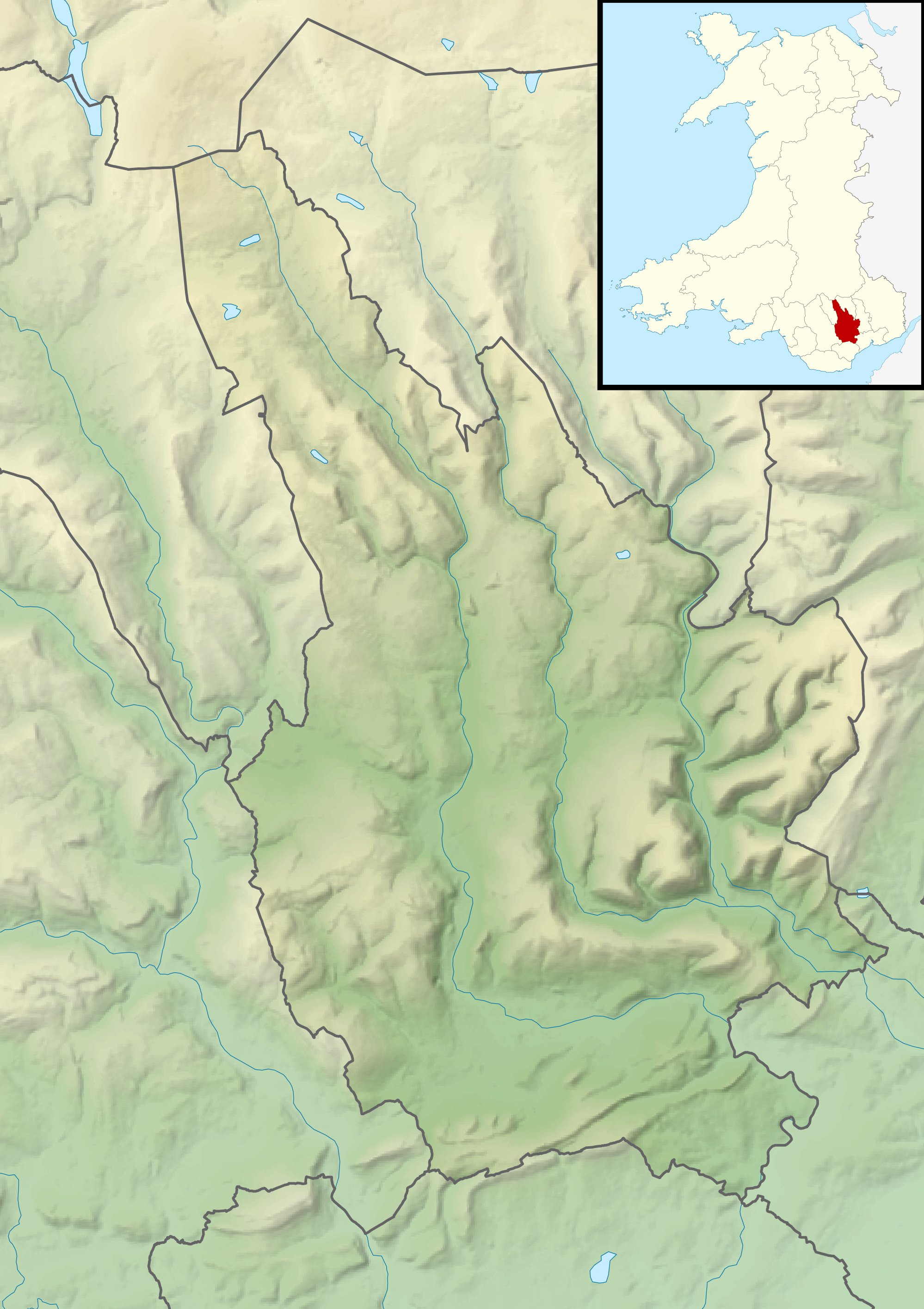
Relief map of Caerphilly, UK. Equirectangular map projection on WGS 84 datum, with N/S stretched 160% Geographic limits:
|
| Petsa | |
| Ginkuhaan |
|
| Awtor | Nilfanion, created using Ordnance Survey data |
| Pagtugot (Gin-uutro paggamit inin nga file) |
Ini nga file in nakalisensya ha ilarom han Creative Commons Attribution-Share Alike 3.0 Unported license. Attribution: Contains Ordnance Survey data © Crown copyright and database right
|
| Other versions | File:Caerphilly UK map.svg - Blank map |
Kaagi han paypay
Pidlita an adlaw/oras para makit-an an fayl nga naggawas hito nga oras.
| Pitsa/Oras | Thumbnail | Mga dimensyon | Gumaramit | Komento | |
|---|---|---|---|---|---|
| waray pa kasasapawi | 00:56, 30 Nobyembre 2011 | | 1,998 × 2,830 (561 nga KB) | Nilfanion | {{Information |Description=Relief map of Caerphilly, UK. Equirectangular map projection on WGS 84 datum, with N/S stretched 160% Geographic limits: *West: 3.40W *East: 3.05W *North: 51.83N *South: 51.52N |Source=[[w:Ordnance Survey|Ordn |
Mga Sumpay
An mga nasunod nga mga pakli nasumpay hini nga paypay:
Global file usage
An masunod nga iba nga mga wiki in nagamit hini nga file:
- Paggamit ha ar.wikipedia.org
- Paggamit ha ceb.wikipedia.org
- Paggamit ha cy.wikipedia.org
- Paggamit ha de.wikipedia.org
- Paggamit ha en.wikipedia.org
- Paggamit ha es.wikipedia.org
- Paggamit ha fr.wikipedia.org
- Paggamit ha ja.wikipedia.org
- Paggamit ha kn.wikipedia.org
- Paggamit ha pl.wikipedia.org
- Paggamit ha pl.wikibooks.org
- Paggamit ha si.wikipedia.org
- Paggamit ha tr.wikipedia.org
- Paggamit ha uz.wikipedia.org
- Paggamit ha zh.wikipedia.org