
Paypay:Czech Republic districts.png
Kadako hin nga pahiuna nga pagawas: 800 × 540 nga mga pixel. Iba nga mga resolusyon: 320 × 216 nga mga pixel | 640 × 432 nga mga pixel | 1,024 × 692 nga mga pixel | 1,300 × 878 nga mga pixel.
Orihinal nga paypay (1,300 × 878 nga pixel, kadako han fayl: 42 nga KB, MIME nga tipo: image/png)
Dalikyat nga pulong
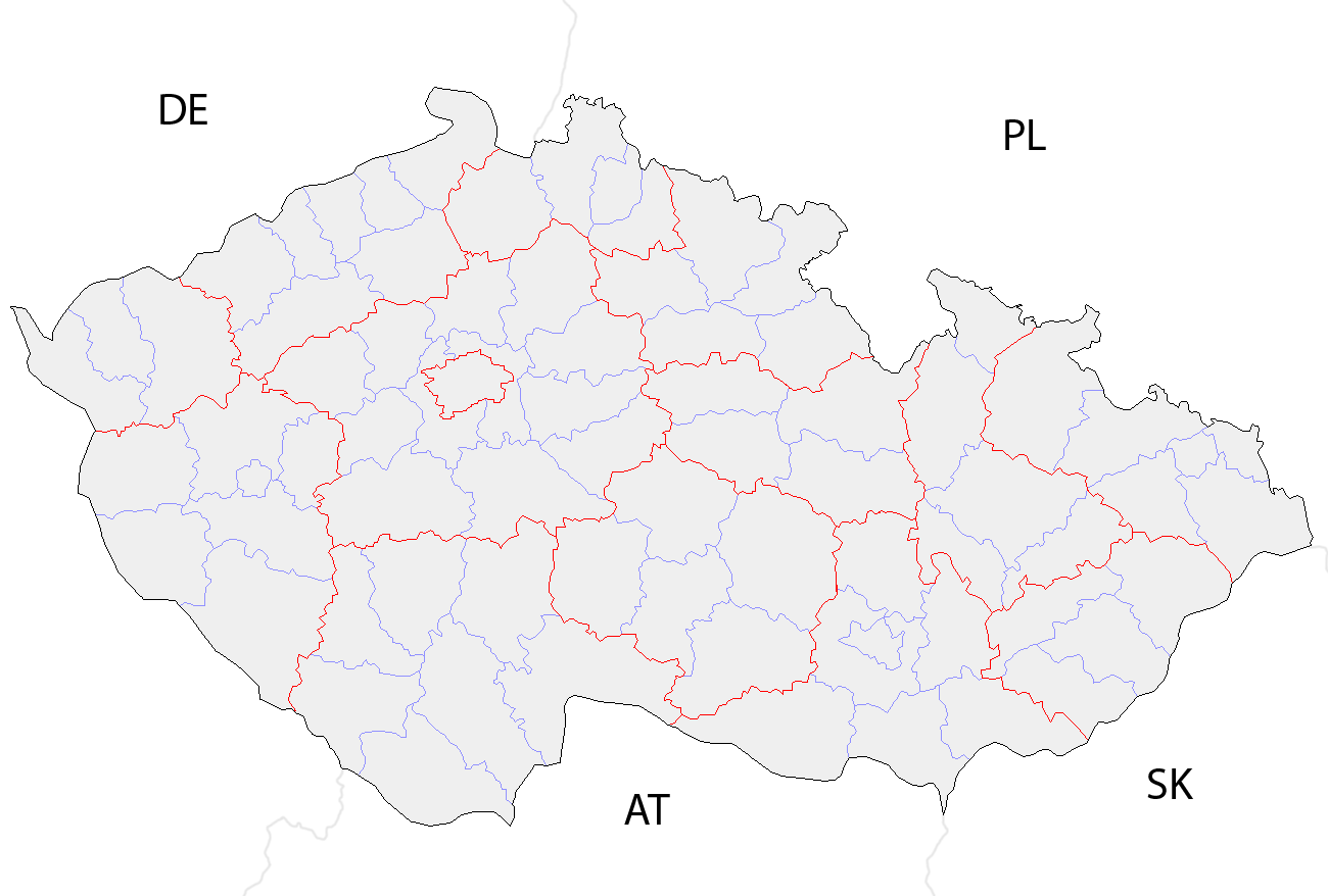
| Tigtulidong | Map of the districts of the Czech Republic showing former district borders before December 31, 2006. Created by Rarelibra 18:42, 29 December 2006 (UTC) for public domain use, using MapInfo Professional v8.5 and various mapping resources. |
| Petsa | 29 Disyembre 2006 (original upload date) |
| Ginkuhaan | No machine-readable source provided. Own work assumed (based on copyright claims). |
| Awtor | No machine-readable author provided. Rarelibra assumed (based on copyright claims). |
Palilisensya:
| I, the copyright holder of this work, release this work into the public domain. This applies worldwide. In some countries this may not be legally possible; if so: I grant anyone the right to use this work for any purpose, without any conditions, unless such conditions are required by law. |
Kaagi han paypay
Pidlita an adlaw/oras para makit-an an fayl nga naggawas hito nga oras.
| Pitsa/Oras | Thumbnail | Mga dimensyon | Gumaramit | Komento | |
|---|---|---|---|---|---|
| waray pa kasasapawi | 10:14, 2 Oktubre 2008 | | 1,300 × 878 (42 nga KB) | Happenstance | rv myself |
| 10:05, 2 Oktubre 2008 |  | 1,300 × 878 (42 nga KB) | Happenstance | lightening country codes | |
| 10:02, 2 Oktubre 2008 |  | 1,300 × 878 (42 nga KB) | Happenstance | added transparency, foreign borders and country codes, separated borders between okresy and borders between kraje | |
| 18:42, 29 Disyembre 2006 |  | 1,281 × 878 (30 nga KB) | Rarelibra | Map of the districts of the Czech Republic. Created by ~~~~ for public domain use, using MapInfo Professional v8.5 and various mapping resources. |
Mga Sumpay
Waray pakli nga nagamit hinin nga file.
Global file usage
An masunod nga iba nga mga wiki in nagamit hini nga file:
- Paggamit ha br.wikipedia.org
- Paggamit ha da.wikipedia.org
- Paggamit ha en.wikipedia.org
- Paggamit ha eo.wikipedia.org
- Paggamit ha es.wikipedia.org
- Paggamit ha fa.wikipedia.org
- Paggamit ha gl.wikipedia.org
- Paggamit ha hu.wikipedia.org
- Paggamit ha it.wikipedia.org
- Paggamit ha ko.wikipedia.org
- Paggamit ha la.wikipedia.org
- Paggamit ha lmo.wikipedia.org
- Paggamit ha ms.wikipedia.org
- Paggamit ha nl.wikipedia.org
- Paggamit ha or.wikipedia.org
- Paggamit ha pa.wikipedia.org
- Paggamit ha pl.wikipedia.org
- Paggamit ha pnb.wikipedia.org
- Paggamit ha pt.wikipedia.org
- Paggamit ha ro.wikipedia.org
- Paggamit ha sh.wikipedia.org
- Paggamit ha sv.wikipedia.org
- Paggamit ha tr.wikipedia.org
- Paggamit ha uk.wikipedia.org
- Paggamit ha ur.wikipedia.org
- Paggamit ha vi.wikipedia.org
- Paggamit ha zh.wikipedia.org