
Paypay:Europe laea location map.svg

Size of this PNG preview of this SVG file: 701 × 599 nga mga pixel. Iba nga mga resolusyon: 281 × 240 nga mga pixel | 561 × 480 nga mga pixel | 898 × 768 nga mga pixel | 1,198 × 1,024 nga mga pixel | 2,395 × 2,048 nga mga pixel | 1,401 × 1,198 nga mga pixel.
Orihinal nga paypay (SVG nga fayl, ginbabanabanahan nga 1,401 × 1,198 nga mga pixel, kadako han fayl: 2.21 nga MB)
Dalikyat nga pulong
| Tigtulidong |
Deutsch: Positionskarte Europa; Politisch mit Staatsgrenzen, Inlandgewässer; Flächentreue Azimutalprojektion
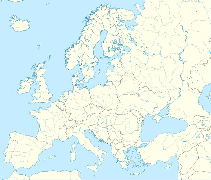
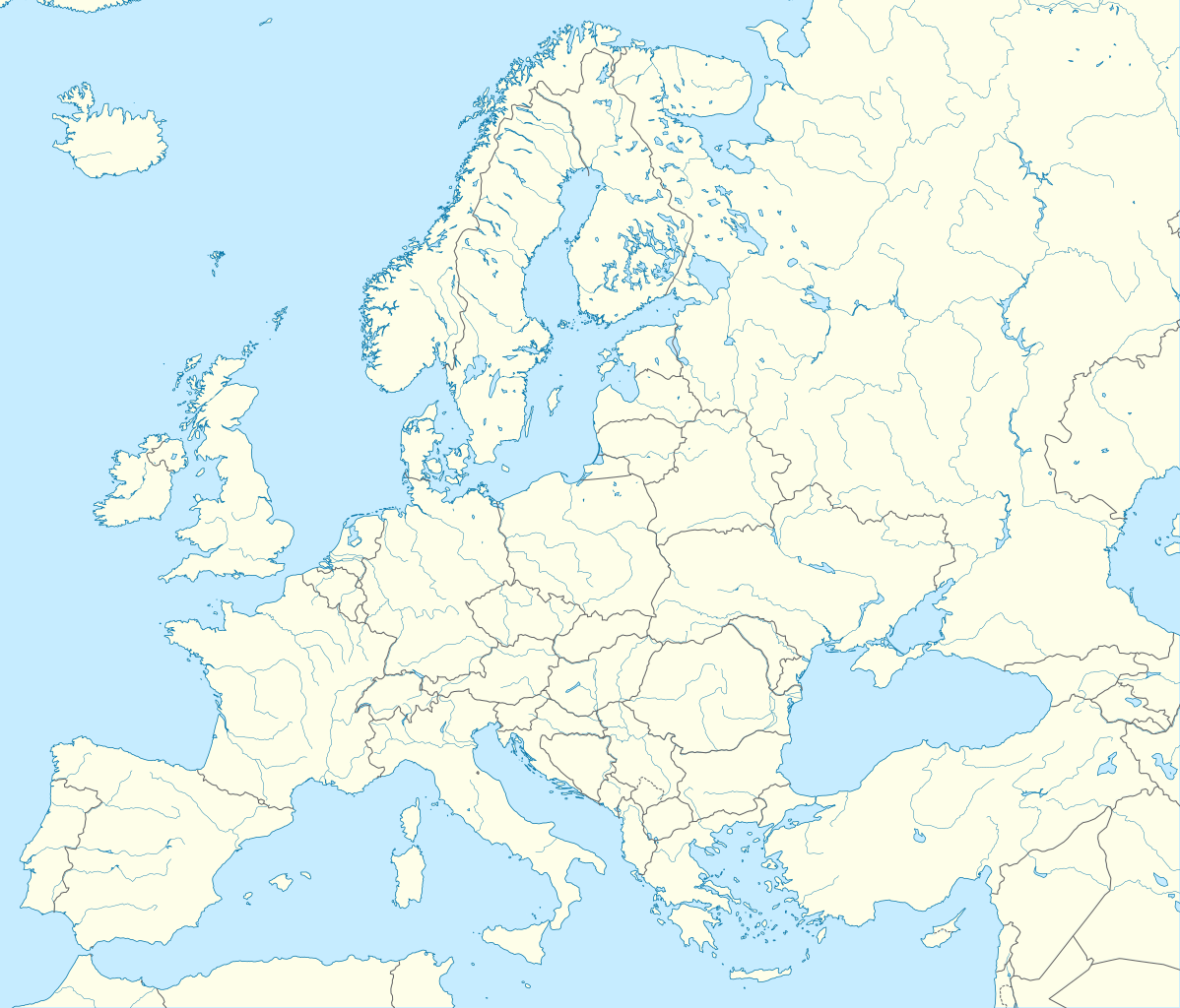
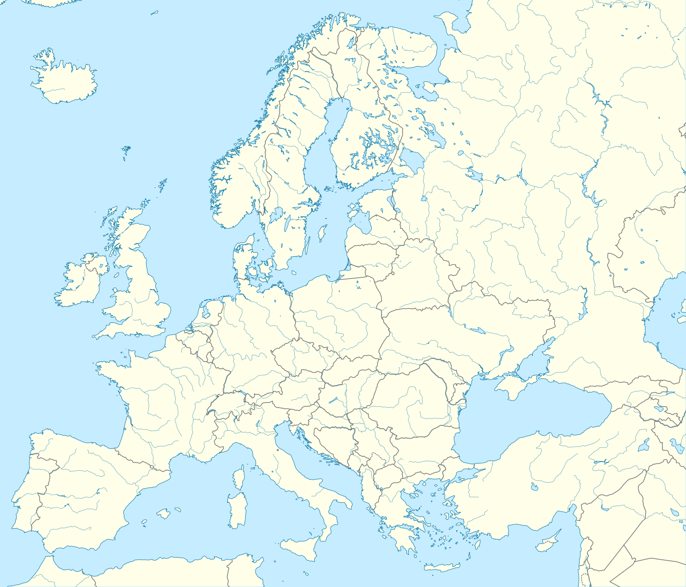
English: Location map Europe; Political with state boundaries, inland water; Lambert azimuthal equal-area projection
Français : Carte de localisation Europe; Politique avec frontières d'Etats, mers intérieures; projection de Lambert azimuthale
Русский: Политическая карта Европы с границами государств и внутренними водами по состоянию на 2010 год (равновеликая азимутальная проекция Ламберта)
|
||
| Petsa | |||
| Ginkuhaan |
Kalugaringon nga buhat
|
||
| Awtor | Alexrk2 | ||
| Other versions |
Derivative works of this file:
[]
|
||
| SVG genesis |
|


.svg)


Palilisensya:
I, the copyright holder of this work, hereby publish it under the following license:
Ini nga file in nakalisensya ha ilarom han Creative Commons Attribution-Share Alike 3.0 Unported license.
- Talwas ka:
- para han pagpasaro – para han pagkopya, pagpakalat ngan pagpadangat han buhat
- para han pagremix – pag-adapt han buhat
- Ha ilarom an masunod nga mga kondisyon:
- attribution – Kinahanglanon mo tagan hin kaangayan nga credit, paghatag hin sumpay ngadto ha lisensya, ngan igbutang an imo ginbag-ohan nga binuhat. Puydi mo ini buhaton ha bisan ano nga resonable nga pamaagi, pero diri nimo pagawson nga an naghatag hin lisensya nag-eendorso ha imo o ha imo paggamit.
- share alike – Kun imo ginsagol-hin-otro, gin-iba, o gin-hingayad han buhat, ikaw in angay gud là magpakalat han imo gin-amot ha ilarom la han [http:creativecommons.org/share-your-work/licensing-considerations/compatible-licenses pareho o naangay nga lisensya] sugad han orihinal.
Kaagi han paypay
Pidlita an adlaw/oras para makit-an an fayl nga naggawas hito nga oras.
| Pitsa/Oras | Thumbnail | Mga dimensyon | Gumaramit | Komento | |
|---|---|---|---|---|---|
| waray pa kasasapawi | 22:57, 20 Agosto 2012 | | 1,401 × 1,198 (2.21 nga MB) | McZusatz | Reverted to version as of 19:40, 10 March 2010 (...thumb fixed?) |
| 22:56, 20 Agosto 2012 |  | 1,401 × 1,198 (1.45 nga MB) | McZusatz | Reverted to version as of 18:44, 10 March 2010 (fixing thumb...) | |
| 19:40, 10 Marso 2010 |  | 1,401 × 1,198 (2.21 nga MB) | Alexrk2 | +San Marino, enh. coastline & countries | |
| 18:44, 10 Marso 2010 |  | 1,401 × 1,198 (1.45 nga MB) | Alexrk2 | == Summary == {{Information |Description= {{de|Positionskarte Europa; Politisch mit Staatsgrenzen, Inlandgewässer; Flächentreue Azimutalprojektion}} {{en|Location map Europe; Political with state boundaries, inland water; L |
Mga Sumpay
Waray pakli nga nagamit hinin nga file.
Global file usage
An masunod nga iba nga mga wiki in nagamit hini nga file:
- Paggamit ha als.wikipedia.org
- Paggamit ha an.wikipedia.org
- Paggamit ha av.wikipedia.org
- Paggamit ha az.wikipedia.org
- Dunay
- Reyn
- UEFA Çempionlar Liqası 1994/1995
- UEFA Çempionlar Liqası 2007/2008
- Şablon:Yer xəritəsi Avropa
- Aqriate
- Akkona (səhra)
- Bardenas-Reales
- Pişinas
- Tabernas (səhra)
- Aleşkov qumları
- Mançester Arenada terror (2017)
- Avropa Gənclər Olimpiya Festivalı
- UEFA Çempionlar Liqası 2017/2018
- Yan çayı
- UEFA Çempionlar Liqası 2018/2019
- Moneqros səhrası
- UEFA Çempionlar Liqası 2019/2020
- UEFA Çempionlar Liqası 2020/2021
- UEFA Çempionlar Liqası 2021/2022
- Paggamit ha ba.wikipedia.org
Kitaa durudamo nga global usage hinin nga file.