
Paypay:Europe relief laea location map.jpg

Kadako hin nga pahiuna nga pagawas: 701 × 599 nga mga pixel. Iba nga mga resolusyon: 281 × 240 nga mga pixel | 561 × 480 nga mga pixel | 898 × 768 nga mga pixel | 1,198 × 1,024 nga mga pixel | 1,580 × 1,351 nga mga pixel.
Orihinal nga paypay (1,580 × 1,351 nga pixel, kadako han fayl: 1.1 nga MB, MIME nga tipo: image/jpeg)
India
Dalikyat nga pulong
| Tigtulidong |
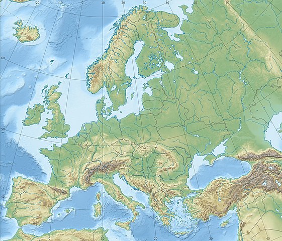
Deutsch: Physische Positionskarte Europa; Flächentreue Azimutalprojektion
English: Physical location map Europe; Lambert azimuthal equal-area projection
|
| Petsa | |
| Ginkuhaan |
Kalugaringon nga buhat
|
| Awtor | Alexrk2 |
| Other versions |
Derivative works of this file:
[]
|


.svg)


_ru.svg)

|
This map has been made or improved in the German Kartenwerkstatt (Map Lab). You can propose maps to improve as well.
|
Palilisensya:
I, the copyright holder of this work, hereby publish it under the following license:
Ini nga file in nakalisensya ha ilarom han Creative Commons Attribution-Share Alike 3.0 Unported license.
- Talwas ka:
- para han pagpasaro – para han pagkopya, pagpakalat ngan pagpadangat han buhat
- para han pagremix – pag-adapt han buhat
- Ha ilarom an masunod nga mga kondisyon:
- attribution – Kinahanglanon mo tagan hin kaangayan nga credit, paghatag hin sumpay ngadto ha lisensya, ngan igbutang an imo ginbag-ohan nga binuhat. Puydi mo ini buhaton ha bisan ano nga resonable nga pamaagi, pero diri nimo pagawson nga an naghatag hin lisensya nag-eendorso ha imo o ha imo paggamit.
- share alike – Kun imo ginsagol-hin-otro, gin-iba, o gin-hingayad han buhat, ikaw in angay gud là magpakalat han imo gin-amot ha ilarom la han [http:creativecommons.org/share-your-work/licensing-considerations/compatible-licenses pareho o naangay nga lisensya] sugad han orihinal.
Kaagi han paypay
Pidlita an adlaw/oras para makit-an an fayl nga naggawas hito nga oras.
| Pitsa/Oras | Thumbnail | Mga dimensyon | Gumaramit | Komento | |
|---|---|---|---|---|---|
| waray pa kasasapawi | 22:29, 4 Hulyo 2018 | | 1,580 × 1,351 (1.1 nga MB) | Subtropical-man | Reverted to version as of 22:56, 20 August 2012 (UTC) |
| 17:54, 2 Hulyo 2018 |  | 1,580 × 1,351 (821 nga KB) | 1970gemini | fiat lux | |
| 22:56, 20 Agosto 2012 |  | 1,580 × 1,351 (1.1 nga MB) | McZusatz | Reverted to version as of 10:53, 14 March 2010 (...thumb fixed?) | |
| 22:55, 20 Agosto 2012 |  | 120 × 103 (4 nga KB) | McZusatz | fixing thumb... | |
| 10:53, 14 Marso 2010 |  | 1,580 × 1,351 (1.1 nga MB) | Alexrk2 | == Summary == {{Information |Description= {{de|Physische Positionskarte Europa; Flächentreue Azimutalprojektion}} {{en|Physical location map Europe; Lambert azimuthal equal-area projection}} * Projection: LAEA Europe, [http: |
Mga Sumpay
An mga nasunod nga mga pakli nasumpay hini nga paypay:
Global file usage
An masunod nga iba nga mga wiki in nagamit hini nga file:
- Paggamit ha ab.wikipedia.org
- Paggamit ha als.wikipedia.org
- Paggamit ha ar.wikipedia.org
- Paggamit ha arz.wikipedia.org
- Paggamit ha ast.wikipedia.org
- Paggamit ha av.wikipedia.org
- Paggamit ha azb.wikipedia.org
- Paggamit ha az.wikipedia.org
Kitaa durudamo nga global usage hinin nga file.