
Paypay:France location map-Regions and departements-2015.svg

Size of this PNG preview of this SVG file: 624 × 600 nga mga pixel. Iba nga mga resolusyon: 250 × 240 nga mga pixel | 499 × 480 nga mga pixel | 799 × 768 nga mga pixel | 1,066 × 1,024 nga mga pixel | 2,131 × 2,048 nga mga pixel | 2,000 × 1,922 nga mga pixel.
Orihinal nga paypay (SVG nga fayl, ginbabanabanahan nga 2,000 × 1,922 nga mga pixel, kadako han fayl: 699 nga KB)
Dalikyat nga pulong
| Tigtulidong |
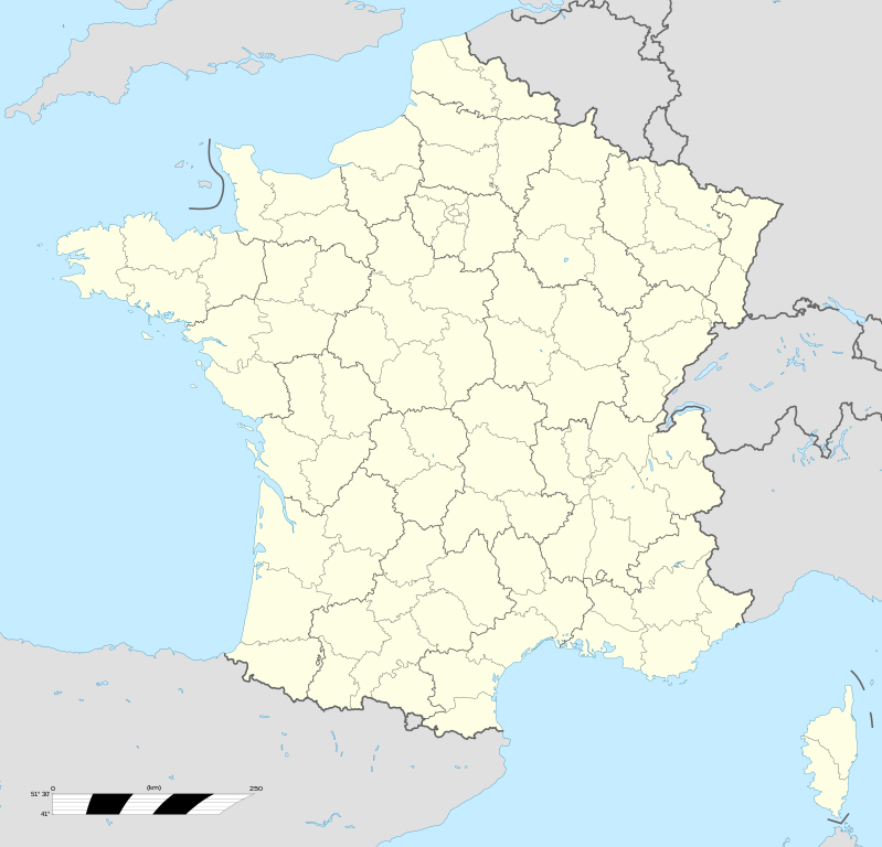
English: Blank administrative map of France for geo-location purpose, with regions and departements distinguished. Approximate scale : 1:3,000,000 Français : Carte administrative vierge de la France destinée à la géolocalisation, avec régions et départements distingués.
Échelle approximative : 1:3 000 000 Equirectangular projection, WGS84 datum
Geographic limits of the map :
|
| Petsa | |
| Ginkuhaan |
Own work based on: France location map-Regions and departements.svg
|
| Awtor | Eric Gaba (Sting - fr:Sting); Ajout Métropole de Lyon: Otourly |
| Other versions |
|
| SVG genesis |


.svg)
| Object location | | View this and other nearby images on: OpenStreetMap |
|---|
Palilisensya:
I, the copyright holder of this work, hereby publish it under the following licenses:

|
An permiso in ginhatag ha pagkopya, pagpakalat ngan/o pagliwat hinin nga dokumento ha ilarom han mga termino han GNU Free Documentation License, Version 1.2 o mas uruurhi nga version nga ginmantala han Free Software Foundation; nga may-ada waray Invariant Sections, waray Front-Cover Texts, ngan waray Back-Cover Texts. May-ada kopya hin lisensya nga ginlalakip ha seksyon nga may-ada pamagat nga GNU Free Documentation License. |
This file is licensed under the Creative Commons Attribution-Share Alike 4.0 International, 3.0 Unported, 2.5 Generic, 2.0 Generic and 1.0 Generic license.
- Talwas ka:
- para han pagpasaro – para han pagkopya, pagpakalat ngan pagpadangat han buhat
- para han pagremix – pag-adapt han buhat
- Ha ilarom an masunod nga mga kondisyon:
- attribution – Kinahanglanon mo tagan hin kaangayan nga credit, paghatag hin sumpay ngadto ha lisensya, ngan igbutang an imo ginbag-ohan nga binuhat. Puydi mo ini buhaton ha bisan ano nga resonable nga pamaagi, pero diri nimo pagawson nga an naghatag hin lisensya nag-eendorso ha imo o ha imo paggamit.
- share alike – Kun imo ginsagol-hin-otro, gin-iba, o gin-hingayad han buhat, ikaw in angay gud là magpakalat han imo gin-amot ha ilarom la han [http:creativecommons.org/share-your-work/licensing-considerations/compatible-licenses pareho o naangay nga lisensya] sugad han orihinal.
Puydi ka pumili hin lisenysa nga karuyag mo.
Kaagi han paypay
Pidlita an adlaw/oras para makit-an an fayl nga naggawas hito nga oras.
| Pitsa/Oras | Thumbnail | Mga dimensyon | Gumaramit | Komento | |
|---|---|---|---|---|---|
| waray pa kasasapawi | 13:49, 19 Oktubre 2017 | | 2,000 × 1,922 (699 nga KB) | Sting | No borders over the Lake of Constance |
| 20:58, 30 Disyembre 2014 |  | 2,000 × 1,922 (700 nga KB) | Otourly | User created page with UploadWizard |
Mga Sumpay
Waray pakli nga nagamit hinin nga file.
Global file usage
An masunod nga iba nga mga wiki in nagamit hini nga file:
- Paggamit ha de.wikipedia.org
- Paggamit ha fr.wikipedia.org
- Paggamit ha hu.wiktionary.org
- Paggamit ha mn.wikipedia.org