
Paypay:FukuiMapCurrent.png
Kadako hin nga pahiuna nga pagawas: 800 × 544 nga mga pixel. Iba nga mga resolusyon: 320 × 218 nga mga pixel | 640 × 435 nga mga pixel | 1,024 × 696 nga mga pixel | 1,181 × 803 nga mga pixel.
Orihinal nga paypay (1,181 × 803 nga pixel, kadako han fayl: 34 nga KB, MIME nga tipo: image/png)
Dalikyat nga pulong
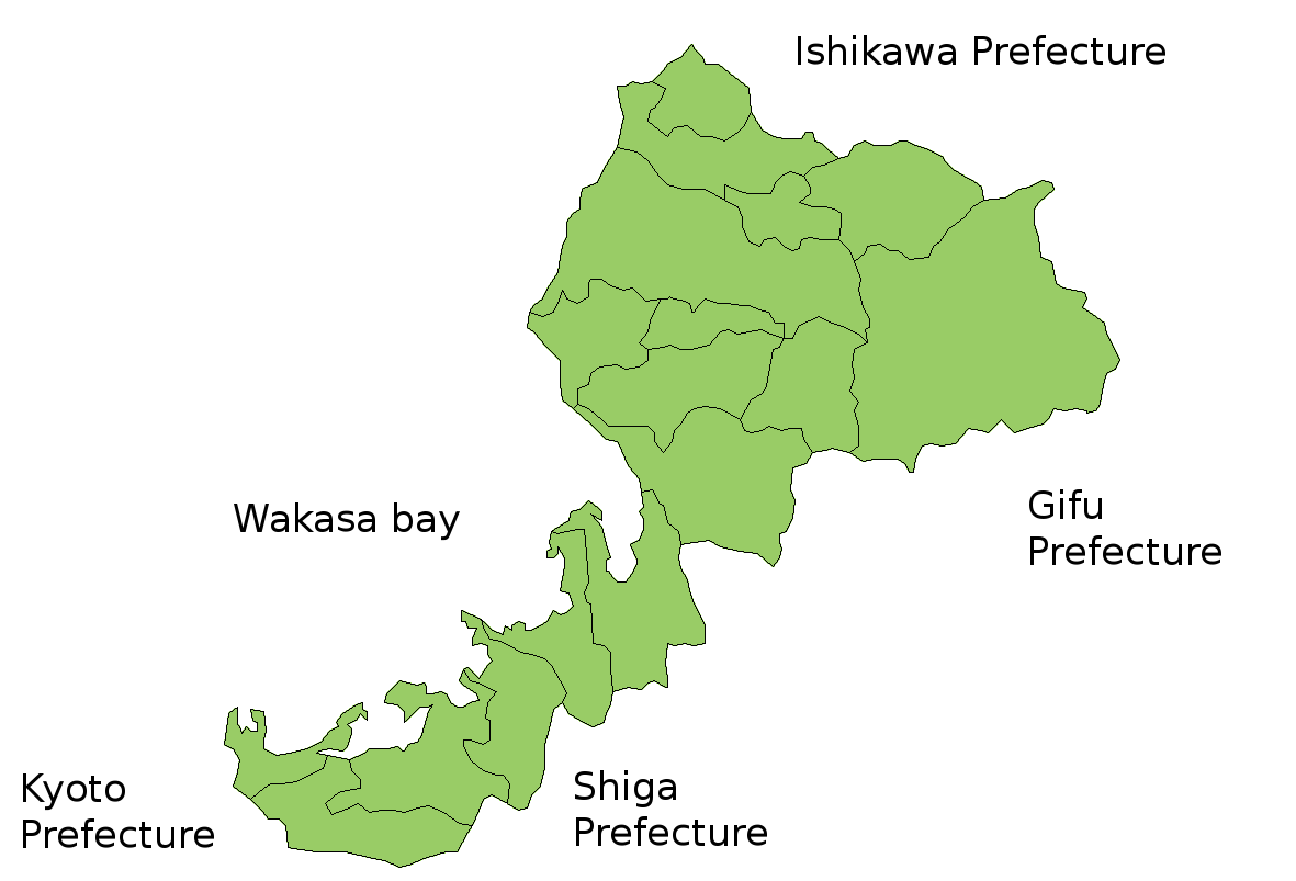
Map of Fukui Prefecture, Japan.
Thanks to Aoki Shigenobu and [1]. Colors from Image:TokyoMapCurrent.png by User:Fg2.
Palilisensya:

|
Shigenobu AOKI, the copyright holder of this work, allows anyone to use it for any purpose including unrestricted redistribution, commercial use, and modification.
|
Kaagi han paypay
Pidlita an adlaw/oras para makit-an an fayl nga naggawas hito nga oras.
| Pitsa/Oras | Thumbnail | Mga dimensyon | Gumaramit | Komento | |
|---|---|---|---|---|---|
| waray pa kasasapawi | 05:37, 19 Hulyo 2006 | | 1,181 × 803 (34 nga KB) | Akanemoto~commonswiki | Reverted to earlier revision |
| 12:19, 18 Hulyo 2006 |  | 930 × 803 (15 nga KB) | Akanemoto~commonswiki | remove texts | |
| 10:41, 18 Hulyo 2006 |  | 1,181 × 803 (34 nga KB) | Akanemoto~commonswiki | Map of Fukui Prefecture, Japan. Thanks to Aoki Shigenobu and [http://aoki2.si.gunma-u.ac.jp/map/map.html]. Colors from Image:TokyoMapCurrent.png by User:Fg2. Category:Maps of Fukui prefecture Category:Maps in English |
Mga Sumpay
Waray pakli nga nagamit hinin nga file.
Global file usage
An masunod nga iba nga mga wiki in nagamit hini nga file:
- Paggamit ha az.wikipedia.org
- Paggamit ha ckb.wikipedia.org
- Paggamit ha cs.wikipedia.org
- Paggamit ha lt.wikipedia.org
- Paggamit ha no.wikipedia.org
- Paggamit ha ru.wikipedia.org