
Paypay:Seto-Inland-Sea-Photo.jpg
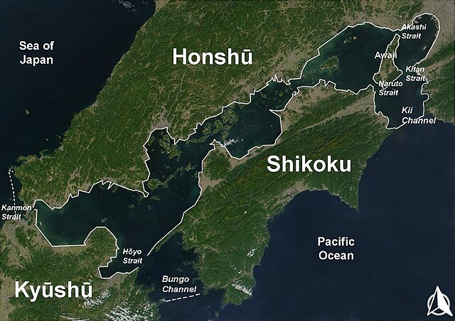
Kadako hin nga pahiuna nga pagawas: 800 × 565 nga mga pixel. Iba nga mga resolusyon: 320 × 226 nga mga pixel | 640 × 452 nga mga pixel | 1,024 × 723 nga mga pixel | 1,280 × 904 nga mga pixel | 1,700 × 1,200 nga mga pixel.
Orihinal nga paypay (1,700 × 1,200 nga pixel, kadako han fayl: 945 nga KB, MIME nga tipo: image/jpeg)
Dalikyat nga pulong
| Tigtulidong |
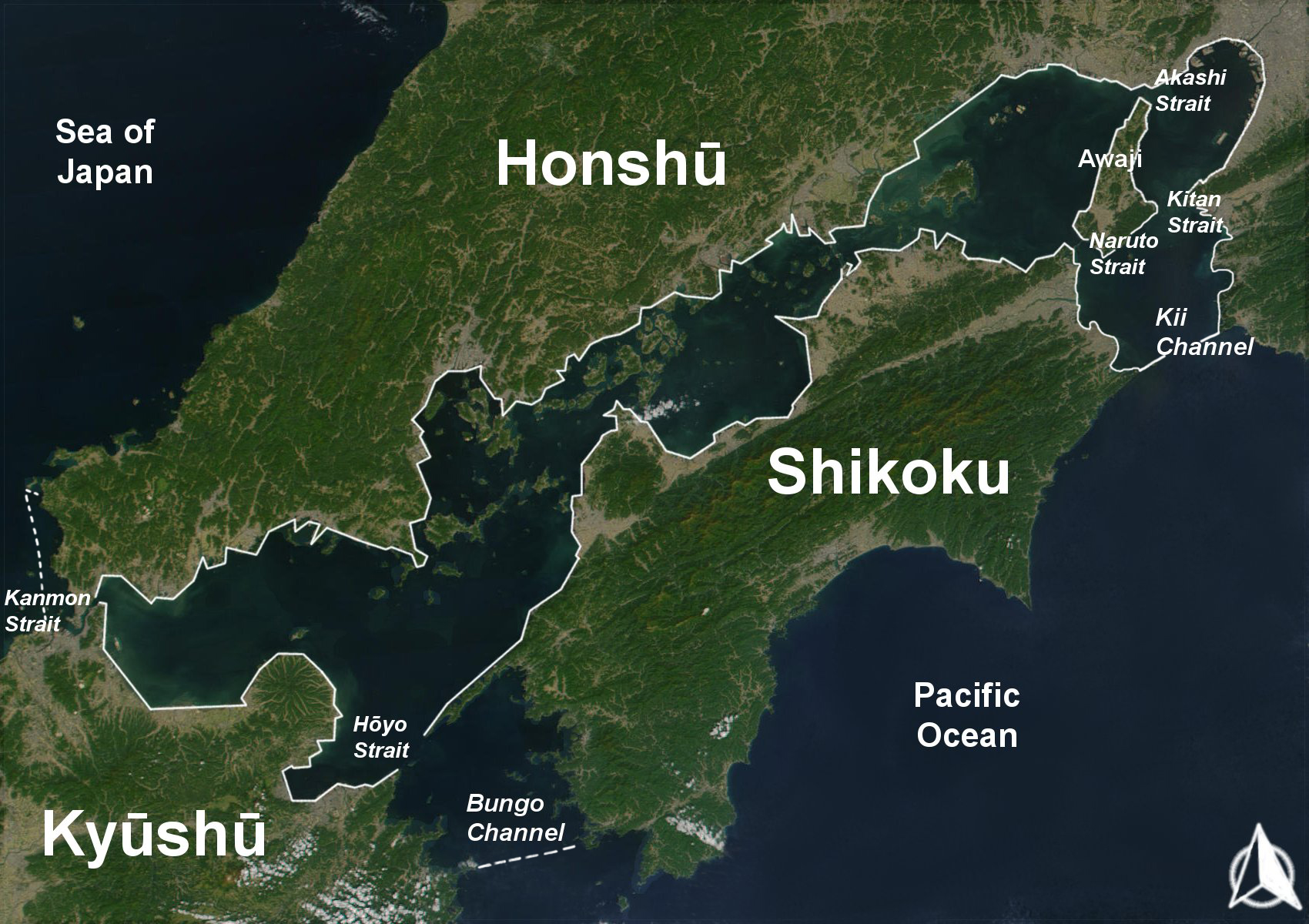
English: The Range of the Seto Inland Sea by the Territorial Sea Law (領海及び接続水域に関する法律) is 19,700 km2 (solid lines). Reference: Seto_Inland_Sea01.png . The Range of the Seto Inland Sea according to the Setouchi Law and the Setouchi Law Enforcement Order is 21,827 km2 (solid lines and dashed lines). Reference: Seto_Inland_Sea02.png.
Español: Mar interior de Seto. Extensión del Mar Interior |
| Petsa | |
| Ginkuhaan | Based on a Public-Domain-Satellite photo of NASA |
| Awtor | User:Guenny (Christian Günther) made this map of the Japanese Inland Sea (Setonaikai,瀬戸内海) for the German Wikipedia. de:Seto-Inlandsee. It's showing the Japanese islands surrounding the sea with the major straits and channels. Guenny is willing to do translations to other languages if needed, as well as corrections and enhancements. |

|
An permiso in ginhatag ha pagkopya, pagpakalat ngan/o pagliwat hinin nga dokumento ha ilarom han mga termino han GNU Free Documentation License, Version 1.2 o mas uruurhi nga version nga ginmantala han Free Software Foundation; nga may-ada waray Invariant Sections, waray Front-Cover Texts, ngan waray Back-Cover Texts. May-ada kopya hin lisensya nga ginlalakip ha seksyon nga may-ada pamagat nga GNU Free Documentation License. |
| Ini nga file in nakalisensya ha ilarom han Creative Commons Attribution-Share Alike 3.0 Unported license. | ||
| ||
| This licensing tag was added to this file as part of the GFDL licensing update. |
Kaagi han paypay
Pidlita an adlaw/oras para makit-an an fayl nga naggawas hito nga oras.
| Pitsa/Oras | Thumbnail | Mga dimensyon | Gumaramit | Komento | |
|---|---|---|---|---|---|
| waray pa kasasapawi | 10:43, 11 Agosto 2019 | | 1,700 × 1,200 (945 nga KB) | Artanisen | Added white solid lines for Kii Channel. |
| 10:32, 11 Agosto 2019 |  | 1,700 × 1,200 (941 nga KB) | Artanisen | Corrected white lines. The Range of the Seto Inland Sea by the Territorial Sea Law is 19,700 km2 (solid lines). Reference: Seto_Inland_Sea01.png . The Range of the Seto Inland Sea according to the Setouchi Law and the Setouchi Law Enforcement Order is 21,827 km2 (solid lines and dashed lines). Reference: Seto_Inland_Sea02.png . | |
| 19:18, 18 Nobyembre 2004 |  | 1,700 × 1,200 (326 nga KB) | Christian Dobrinoff | {{GFDL}} |
Mga Sumpay
An mga nasunod nga mga pakli nasumpay hini nga paypay:
Global file usage
An masunod nga iba nga mga wiki in nagamit hini nga file:
- Paggamit ha an.wikipedia.org
- Paggamit ha ar.wikipedia.org
- Paggamit ha ast.wikipedia.org
- Paggamit ha avk.wikipedia.org
- Paggamit ha azb.wikipedia.org
- Paggamit ha az.wikipedia.org
- Paggamit ha bn.wikipedia.org
- Paggamit ha br.wikipedia.org
- Paggamit ha bs.wikipedia.org
- Paggamit ha ca.wikipedia.org
- Paggamit ha cs.wikipedia.org
- Paggamit ha da.wikipedia.org
- Paggamit ha de.wikipedia.org
- Paggamit ha el.wikipedia.org
- Paggamit ha en.wikipedia.org
- Paggamit ha en.wiktionary.org
- Paggamit ha eo.wikipedia.org
- Paggamit ha es.wikipedia.org
- Paggamit ha et.wikipedia.org
- Paggamit ha eu.wikipedia.org
- Paggamit ha fa.wikipedia.org
- Paggamit ha fi.wikipedia.org
- Paggamit ha fr.wikipedia.org
- Paggamit ha fy.wikipedia.org
- Paggamit ha gl.wikipedia.org
- Paggamit ha he.wikipedia.org
- Paggamit ha hr.wikipedia.org
- Paggamit ha hu.wikipedia.org
- Paggamit ha id.wikipedia.org
- Paggamit ha is.wikipedia.org
- Paggamit ha it.wikipedia.org
Kitaa durudamo nga global usage hinin nga file.