
Paypay:Isle of Man location map.svg

Size of this PNG preview of this SVG file: 654 × 600 nga mga pixel. Iba nga mga resolusyon: 262 × 240 nga mga pixel | 524 × 480 nga mga pixel | 838 × 768 nga mga pixel | 1,117 × 1,024 nga mga pixel | 2,234 × 2,048 nga mga pixel | 1,200 × 1,100 nga mga pixel.
Orihinal nga paypay (SVG nga fayl, ginbabanabanahan nga 1,200 × 1,100 nga mga pixel, kadako han fayl: 93 nga KB)
| Tigtulidong |
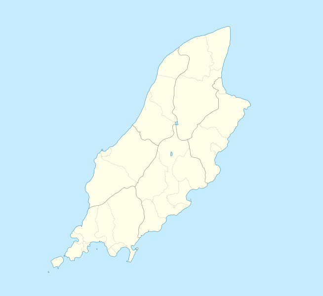
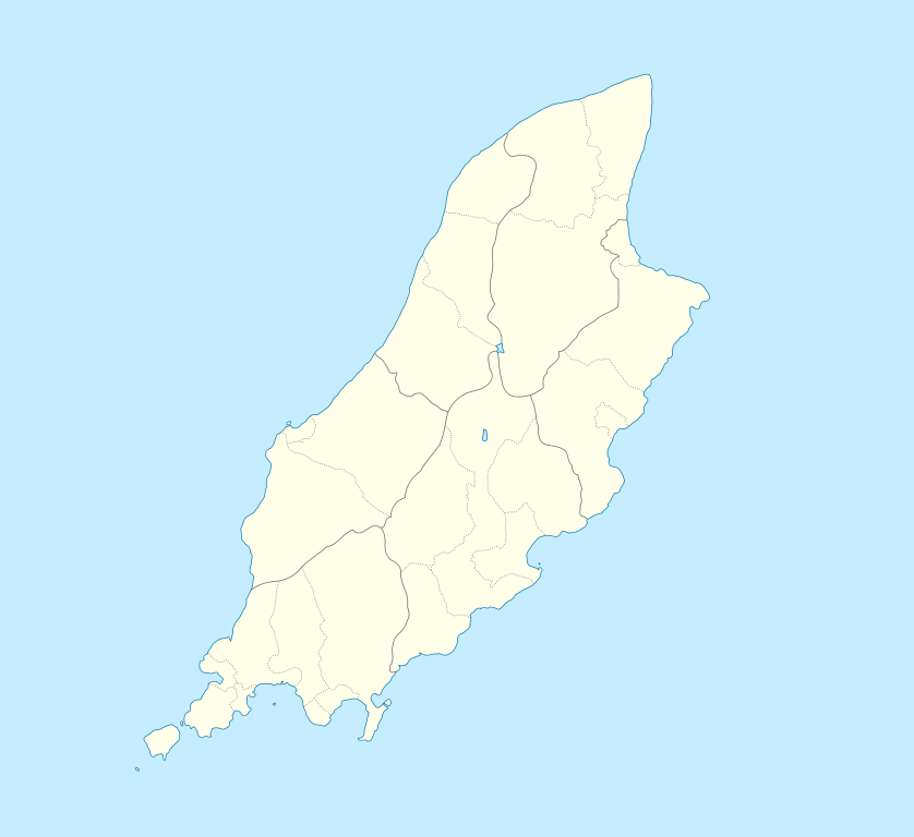
English: Location map of the Isle of Man, showing sheadings as well as local authorities (towns, villages, districts, parishes).
Geographic limits of the map:
|
| Petsa | |
| Ginkuhaan | |
| Awtor |
|
I, the copyright holder of this work, hereby publish it under the following licenses:
This file is licensed under the Creative Commons Attribution-Share Alike 2.5 Generic, 2.0 Generic and 1.0 Generic license.
- Talwas ka:
- para han pagpasaro – para han pagkopya, pagpakalat ngan pagpadangat han buhat
- para han pagremix – pag-adapt han buhat
- Ha ilarom an masunod nga mga kondisyon:
- attribution – Kinahanglanon mo tagan hin kaangayan nga credit, paghatag hin sumpay ngadto ha lisensya, ngan igbutang an imo ginbag-ohan nga binuhat. Puydi mo ini buhaton ha bisan ano nga resonable nga pamaagi, pero diri nimo pagawson nga an naghatag hin lisensya nag-eendorso ha imo o ha imo paggamit.
- share alike – Kun imo ginsagol-hin-otro, gin-iba, o gin-hingayad han buhat, ikaw in angay gud là magpakalat han imo gin-amot ha ilarom la han [http:creativecommons.org/share-your-work/licensing-considerations/compatible-licenses pareho o naangay nga lisensya] sugad han orihinal.
| Ini nga file in nakalisensya ha ilarom han Creative Commons Attribution-Share Alike 3.0 Unported license. | ||
| ||
| This licensing tag was added to this file as part of the GFDL licensing update. |

|
An permiso in ginhatag ha pagkopya, pagpakalat ngan/o pagliwat hinin nga dokumento ha ilarom han mga termino han GNU Free Documentation License, Version 1.2 o mas uruurhi nga version nga ginmantala han Free Software Foundation; nga may-ada waray Invariant Sections, waray Front-Cover Texts, ngan waray Back-Cover Texts. May-ada kopya hin lisensya nga ginlalakip ha seksyon nga may-ada pamagat nga GNU Free Documentation License. |
Puydi ka pumili hin lisenysa nga karuyag mo.
Original upload log
This image is a derivative work of the following images:
- File:IsleOfMan_SheadingsAndParishes-en.svg licensed with Cc-by-sa-2.5,2.0,1.0, Cc-by-sa-3.0-migrated, GFDL
- 2008-01-17T12:48:28Z Sémhur 1200x1100 (227618 Bytes) Update
- 2007-05-29T20:36:04Z Sémhur 1200x1100 (364350 Bytes) {{Information |Description=Map in english of the [[:en:Isle of Man|Isle of Man]], with bounds of sheadings, towns, villages, districts and parishes. |Source=Own work. Based on maps [[:Image:Isle of Man map-fr.svg]], [[:Image:
Uploaded with derivativeFX
Kaagi han paypay
Pidlita an adlaw/oras para makit-an an fayl nga naggawas hito nga oras.
| Pitsa/Oras | Thumbnail | Mga dimensyon | Gumaramit | Komento | |
|---|---|---|---|---|---|
| waray pa kasasapawi | 23:00, 24 Septyembre 2009 | | 1,200 × 1,100 (93 nga KB) | Entlinkt | {{Information |Description={{en|1=Location map of the Isle of Man, showing sheadings as well as local authorities (towns, villages, districts, parishes). Geographic limits of the map: * W: -4° 58' 0" * E: -4° 7' 0" * S: 54° 0' 0" * N: 54° 27' 30"}} |
Mga Sumpay
An mga nasunod nga mga pakli nasumpay hini nga paypay:
Global file usage
An masunod nga iba nga mga wiki in nagamit hini nga file:
- Paggamit ha af.wikipedia.org
- Paggamit ha ar.wikipedia.org
- Paggamit ha ast.wikipedia.org
- Paggamit ha azb.wikipedia.org
- Paggamit ha ba.wikipedia.org
- Paggamit ha be.wikipedia.org
- Paggamit ha bg.wikipedia.org
- Paggamit ha bn.wikipedia.org
- Paggamit ha br.wikipedia.org
- Paggamit ha ceb.wikipedia.org
- Plantilya:Location map Isle of Man
- German
- Patrick
- Bride
- Andreas
- Douglas
- Saint Michaels Island
- Port Douglas
- Peel
- Isle of Man (pagklaro)
- Douglas Bay
- Isle of Man
- Santon
- Clay Head
- Craig Rock
- Ramsey Bay
- Rue Point
- Ramsey
- River Glass
- Chicken Rock
- Castletown
- Calf Sound
- Point of Ayre
- Crosby
- Little Ness
- Laksaa
- Snaefell
Kitaa durudamo nga global usage hinin nga file.