
Paypay:LocationOceania.png

Kadako hin nga pahiuna nga pagawas: 800 × 407 nga mga pixel. Iba nga mga resolusyon: 320 × 163 nga mga pixel | 640 × 326 nga mga pixel | 1,024 × 521 nga mga pixel | 1,280 × 651 nga mga pixel | 2,759 × 1,404 nga mga pixel.
Orihinal nga paypay (2,759 × 1,404 nga pixel, kadako han fayl: 98 nga KB, MIME nga tipo: image/png)
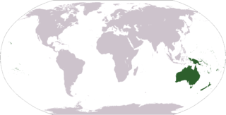
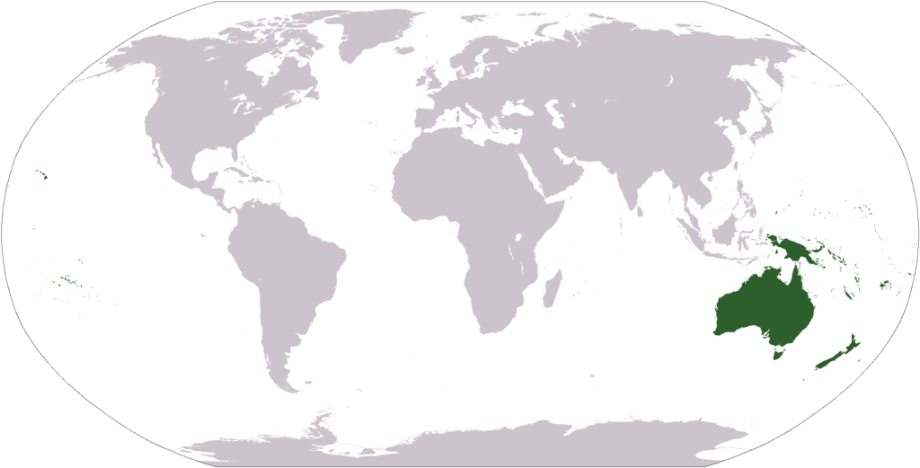
World map depicting Oceania; map adapted from PDF world map at CIA World Fact Book
Light Green: Regions often included in Oceania

|
File:LocationOceania.svg is a vector version of this file. It should be used in place of this PNG file when not inferior.
File:LocationOceania.png → File:LocationOceania.svg
For more information, see Help:SVG. |
 |
This image is in the public domain because it contains materials that originally came from the United States Central Intelligence Agency's World Factbook.
|
 |
derivative works
Derivative works of this file: Wikinews Australia i Oceania mapa.png
Kaagi han paypay
Pidlita an adlaw/oras para makit-an an fayl nga naggawas hito nga oras.
| Pitsa/Oras | Thumbnail | Mga dimensyon | Gumaramit | Komento | |
|---|---|---|---|---|---|
| waray pa kasasapawi | 02:38, 15 Marso 2008 | | 2,759 × 1,404 (98 nga KB) | Corticopious | Reverted to version as of 12:42, 19 January 2008 |
| 14:42, 10 Pebrero 2008 |  | 2,759 × 1,404 (161 nga KB) | Luis wiki | {{PD-USGov-CIA-WF}} | |
| 12:42, 19 Enero 2008 |  | 2,759 × 1,404 (98 nga KB) | F l a n k e r | Transparency | |
| 13:43, 1 Oktubre 2006 |  | 2,759 × 1,404 (55 nga KB) | Cogito ergo sumo~commonswiki | World map: Oceania (location) | |
| 21:08, 2 Septyembre 2006 |  | 2,759 × 1,404 (55 nga KB) | Cogito ergo sumo~commonswiki | World map: Oceania (location) | |
| 07:35, 30 Enero 2006 |  | 2,759 × 1,404 (55 nga KB) | E Pluribus Anthony~commonswiki | World map: Oceania (location) | |
| 17:05, 10 Oktubre 2005 |  | 2,759 × 1,404 (55 nga KB) | Carlosar~commonswiki | Oceania's place in the world. Category:Continent locator maps |
Mga Sumpay
An mga nasunod nga mga pakli nasumpay hini nga paypay:
Global file usage
An masunod nga iba nga mga wiki in nagamit hini nga file:
- Paggamit ha af.wikipedia.org
- Australasië
- Midde-Ooste
- Sentraal-Amerika
- Atlantiese Oseaan
- Suider-Afrika
- Indiese Oseaan
- Suidelike Oseaan
- Arktiese Oseaan
- Nederlandse koloniale ryk
- Stille Oseaan
- Latyns-Amerika
- Oos-Asië
- Sjabloon:Gebiede van die wêreld
- Noord-Europa
- Melanesië
- Mikronesië
- Polinesië
- Oos-Afrika
- Wes-Afrika
- Noord-Afrika
- Oos-Europa
- Verre Ooste
- Sentraal-Afrika
- Afrika suid van die Sahara
- Seelandië
- Noordpoolgebied
- Karibiese gebied
- Indiese subkontinent
- Suidoos-Asië
- Wes-Asië
- Wes-Europa
- Suid-Europa
- Suid-Asië
- Sentraal-Asië
- Sentraal-Europa
- Suidoos-Europa
- Noord-Asië
- Paggamit ha am.wikipedia.org
- Paggamit ha arc.wikipedia.org
Kitaa durudamo nga global usage hinin nga file.