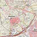
Paypay:MTN25-0695c2-2017-Lliria.jpg

Page contents not supported in other languages.
Tikang ha Wikipedia

Orihinal nga paypay(7,553 × 5,069 nga pixel, kadako han fayl: 23.05 nga MB, MIME nga tipo: image/jpeg)

An fayl in tikang ha Wikimedia Commons ngan puydi mahigamitan para han iba nga mga proyekto. An paglaladawan han iya fayl han paglaladawan nga pakli didto in ginpapakita ha sirong.

Dalikyat nga pulong

Title
Mapa MTN25-0695c2-2017-Lliria
Description
Español: Fragmento 0695c2 del Mapa Topográfico Nacional de España del año 2017 a escala 1:25000 impreso y escaneado a 250 ppp. Se representa Lliria.
English: Fragment 0695c2 of the National Topographic Map of Spain in 2017 at a scale of 1:25000 printed and scanned with a resolution of 250 ppi. It shows Lliria.
Petsa
Ginkuhaan https://centrodedescargas.cnig.es/CentroDescargas/
Creator
Centro Nacional de Información Geográfica    wikidata:Q5761415
 
Alternative names
Centro Nacional de Informacion Geografica
Authority file
creator QS:P170,Q5761415
Pagtugot
(Gin-uutro paggamit inin nga file)
w:en:Creative Commons
attribution
This file is licensed under the Creative Commons Attribution 4.0 International license.
Talwas ka:
  • para han pagpasaro – para han pagkopya, pagpakalat ngan pagpadangat han buhat
  • para han pagremix – pag-adapt han buhat
Ha ilarom an masunod nga mga kondisyon:
  • attribution – Kinahanglanon mo tagan hin kaangayan nga credit, paghatag hin sumpay ngadto ha lisensya, ngan igbutang an imo ginbag-ohan nga binuhat. Puydi mo ini buhaton ha bisan ano nga resonable nga pamaagi, pero diri nimo pagawson nga an naghatag hin lisensya nag-eendorso ha imo o ha imo paggamit.
 Geotemporal data
Map location Llíria (Q23067)
Map type topographic map (Q216526)
Scale 1:25,000
Georeferencing Georeference the map in Wikimaps Warper If inappropriate please set warp_status = skip to hide.
 Bibliographic data
Part of the series National Topographic Map 1:25000 printed (Q60543124)
Map sheet 0695c2
Language Spanish
Place of publication Madrid (Q2807)
Publisher
Centro Nacional de Información Geográfica    wikidata:Q5761415
 
Alternative names
Centro Nacional de Informacion Geografica
Authority file
creator QS:P170,Q5761415
 Archival data
institution QS:P195,Q3137513
Notes
Other versions


Palilisensya:

w:en:Creative Commons
attribution
This file is licensed under the Creative Commons Attribution 4.0 International license.
Talwas ka:
  • para han pagpasaro – para han pagkopya, pagpakalat ngan pagpadangat han buhat
  • para han pagremix – pag-adapt han buhat
Ha ilarom an masunod nga mga kondisyon:
  • attribution – Kinahanglanon mo tagan hin kaangayan nga credit, paghatag hin sumpay ngadto ha lisensya, ngan igbutang an imo ginbag-ohan nga binuhat. Puydi mo ini buhaton ha bisan ano nga resonable nga pamaagi, pero diri nimo pagawson nga an naghatag hin lisensya nag-eendorso ha imo o ha imo paggamit.

Captions

Add a one-line explanation of what this file represents

Items portrayed in this file

depicts English

copyrighted English

sponsor English

media type English

image/jpeg

Kaagi han paypay

Pidlita an adlaw/oras para makit-an an fayl nga naggawas hito nga oras.

Pitsa/OrasThumbnailMga dimensyonGumaramitKomento
waray pa kasasapawi02:31, 30 Enero 2019Bersyon han thumbnail han 02:31, 30 Enero 20197,553 × 5,069 (23.05 nga MB)Abián== {{int:description}} == {{Map |title = Mapa MTN25-0695c2-2017-Lliria |description = {{es|Fragmento 0695c2 del Mapa Topográfico Nacional de España del año 2017 a escala 1:25000 impreso y escaneado a 250 ppp. Se representa Lliria.}}{{en|Fragment 0695c2 of the National Topographic Map of Spain in 2017 at a scale of 1:25000 printed and scanned with a resolution of 250 ppi. It shows Lliria.}} |legend = |author = {{Creator:Centro Nacional de Informació...

Waray pakli nga nagamit hinin nga file.

Metadata