
Paypay:Netherlands location map 1944.svg

Size of this PNG preview of this SVG file: 532 × 600 nga mga pixel. Iba nga mga resolusyon: 213 × 240 nga mga pixel | 426 × 480 nga mga pixel | 681 × 768 nga mga pixel | 908 × 1,024 nga mga pixel | 1,817 × 2,048 nga mga pixel | 888 × 1,001 nga mga pixel.
Orihinal nga paypay (SVG nga fayl, ginbabanabanahan nga 888 × 1,001 nga mga pixel, kadako han fayl: 1.32 nga MB)
Dalikyat nga pulong
| Tigtulidong |
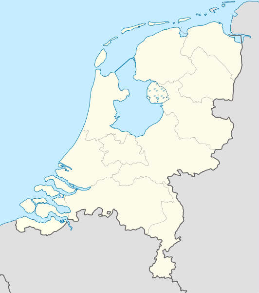
Deutsch: Positionskarte der Niederlande für das Jahr 1944
Quadratische Plattkarte, N-S-Streckung 160 %. Geographische Begrenzung der Karte:
English: Location map of the Netherlands as of 1944
Equirectangular projection, N/S stretching 160 %. Geographic limits of the map:
|
| Petsa | |
| Ginkuhaan |
Kalugaringon nga buhat This W3C-unspecified vector image was created with Adobe Illustrator. This vector image includes elements that have been taken or adapted from this file: |
| Awtor | Lencer |

|
This map has been made or improved in the German Kartenwerkstatt (Map Lab). You can propose maps to improve as well.
|
Palilisensya:
I, the copyright holder of this work, hereby publish it under the following licenses:

|
An permiso in ginhatag ha pagkopya, pagpakalat ngan/o pagliwat hinin nga dokumento ha ilarom han mga termino han GNU Free Documentation License, Version 1.2 o mas uruurhi nga version nga ginmantala han Free Software Foundation; nga may-ada waray Invariant Sections, waray Front-Cover Texts, ngan waray Back-Cover Texts. May-ada kopya hin lisensya nga ginlalakip ha seksyon nga may-ada pamagat nga GNU Free Documentation License. |
Ini nga file in nakalisensya ha ilarom han Creative Commons Attribution-Share Alike 3.0 Unported license.
- Talwas ka:
- para han pagpasaro – para han pagkopya, pagpakalat ngan pagpadangat han buhat
- para han pagremix – pag-adapt han buhat
- Ha ilarom an masunod nga mga kondisyon:
- attribution – Kinahanglanon mo tagan hin kaangayan nga credit, paghatag hin sumpay ngadto ha lisensya, ngan igbutang an imo ginbag-ohan nga binuhat. Puydi mo ini buhaton ha bisan ano nga resonable nga pamaagi, pero diri nimo pagawson nga an naghatag hin lisensya nag-eendorso ha imo o ha imo paggamit.
- share alike – Kun imo ginsagol-hin-otro, gin-iba, o gin-hingayad han buhat, ikaw in angay gud là magpakalat han imo gin-amot ha ilarom la han [http:creativecommons.org/share-your-work/licensing-considerations/compatible-licenses pareho o naangay nga lisensya] sugad han orihinal.
Puydi ka pumili hin lisenysa nga karuyag mo.
Kaagi han paypay
Pidlita an adlaw/oras para makit-an an fayl nga naggawas hito nga oras.
| Pitsa/Oras | Thumbnail | Mga dimensyon | Gumaramit | Komento | |
|---|---|---|---|---|---|
| waray pa kasasapawi | 09:34, 9 Hulyo 2011 | | 888 × 1,001 (1.32 nga MB) | TUBS | Lauwerszee was keeen maar, Europoort nok niet; Sloe was niet afsluiten, Neeltje Jans en de eilanden bij Goeree es Schouwen was nog niet, Sint Philipsland was en eiland |
| 17:52, 6 Hulyo 2011 |  | 888 × 1,001 (281 nga KB) | TUBS | corr | |
| 14:04, 6 Hulyo 2011 |  | 888 × 1,001 (281 nga KB) | TUBS | corr | |
| 13:59, 6 Hulyo 2011 |  | 888 × 1,001 (281 nga KB) | TUBS | == {{int:filedesc}} == {{Information |Description= {{de|Positionskarte der Niederlande für das Jahr 1944}} Quadratische Plattkarte, N-S-Streckung 160 %. Geographische Begrenzung der Karte: * N: 53.7° N * S: 50.6° N * W: 3.1° |
Mga Sumpay
An mga nasunod nga mga pakli nasumpay hini nga paypay:
Global file usage
An masunod nga iba nga mga wiki in nagamit hini nga file:
- Paggamit ha als.wikipedia.org
- Paggamit ha ar.wikipedia.org
- Paggamit ha ceb.wikipedia.org
- Paggamit ha ckb.wikipedia.org
- Paggamit ha de.wikipedia.org
- Paggamit ha es.wikipedia.org
- Paggamit ha frr.wikipedia.org
- Paggamit ha ka.wikipedia.org
- Paggamit ha mk.wikipedia.org
- Paggamit ha ml.wikipedia.org
- Paggamit ha mn.wikipedia.org
- Paggamit ha pl.wikipedia.org
- Paggamit ha pl.wikibooks.org
- Paggamit ha sco.wikipedia.org
- Paggamit ha sl.wikipedia.org
- Paggamit ha sq.wikipedia.org
- Paggamit ha tg.wikipedia.org
- Paggamit ha xmf.wikipedia.org
- Paggamit ha zh.wikipedia.org