
Paypay:North Lanarkshire UK location map.svg

Size of this PNG preview of this SVG file: 509 × 599 nga mga pixel. Iba nga mga resolusyon: 204 × 240 nga mga pixel | 408 × 480 nga mga pixel | 653 × 768 nga mga pixel | 870 × 1,024 nga mga pixel | 1,740 × 2,048 nga mga pixel | 1,176 × 1,384 nga mga pixel.
Orihinal nga paypay (SVG nga fayl, ginbabanabanahan nga 1,176 × 1,384 nga mga pixel, kadako han fayl: 1.14 nga MB)
| Tigtulidong |
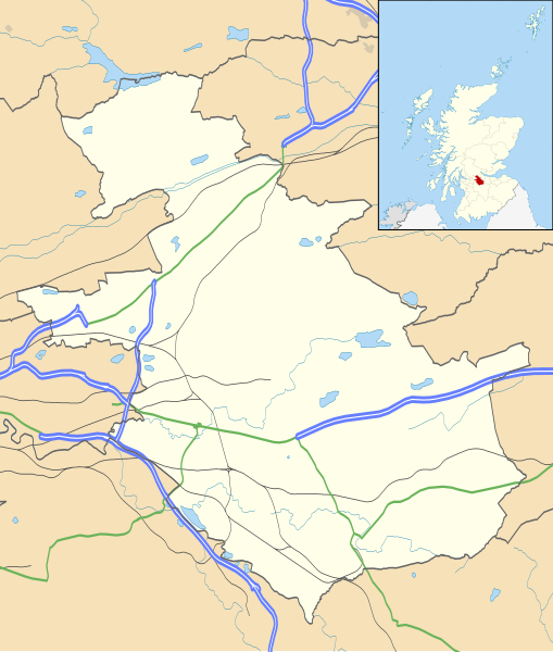
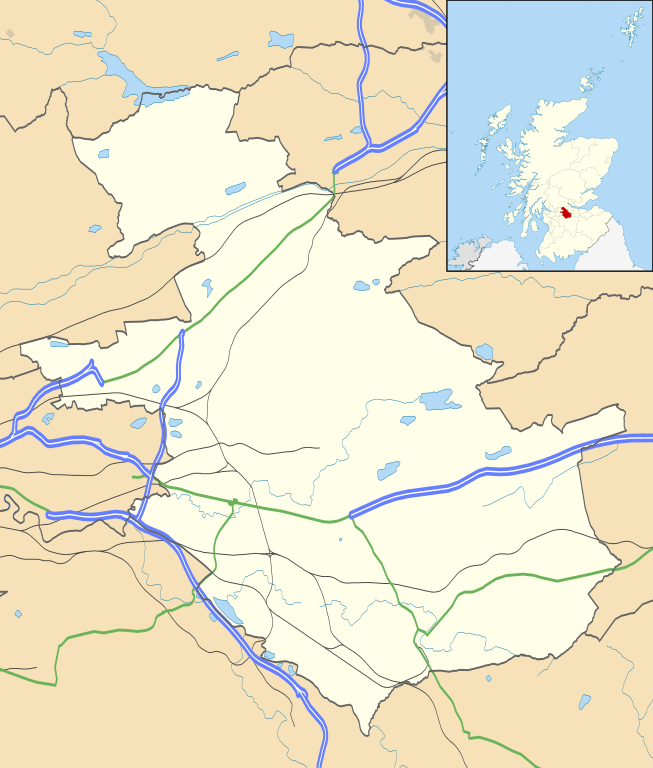
Blank map of North Lanarkshire, UK with the following information shown:
Equirectangular map projection on WGS 84 datum, with N/S stretched 175% Geographic limits:
|
| Petsa | |
| Ginkuhaan |
|
| Awtor | Nilfanion, created using Ordnance Survey data |
| Pagtugot (Gin-uutro paggamit inin nga file) |
Ini nga file in nakalisensya ha ilarom han Creative Commons Attribution-Share Alike 3.0 Unported license. Attribution: Contains Ordnance Survey data © Crown copyright and database right
|
| Other versions | File:North Lanarkshire UK blank map.svg - Blank map |
Kaagi han paypay
Pidlita an adlaw/oras para makit-an an fayl nga naggawas hito nga oras.
| Pitsa/Oras | Thumbnail | Mga dimensyon | Gumaramit | Komento | |
|---|---|---|---|---|---|
| waray pa kasasapawi | 20:20, 26 Septyembre 2010 | | 1,176 × 1,384 (1.14 nga MB) | Nilfanion | {{Information |Description=Blank map of North Lanarkshire, UK with the following information shown: *Administrative borders *Coastline, lakes and rivers *Roads and railways *Urban areas Equirectangular map projection on WGS 84 dat |
Mga Sumpay
An mga nasunod nga mga pakli nasumpay hini nga paypay:
Global file usage
An masunod nga iba nga mga wiki in nagamit hini nga file:
- Paggamit ha ar.wikipedia.org
- Paggamit ha bg.wikipedia.org
- Paggamit ha ceb.wikipedia.org
- Paggamit ha de.wikipedia.org
- Paggamit ha en.wikipedia.org
- Airdrie, North Lanarkshire
- North Lanarkshire
- Motherwell
- Coatbridge
- Kilsyth
- Wishaw
- Fir Park
- Bellshill
- Cleland, North Lanarkshire
- Bargeddie
- Excelsior Stadium
- Calderbank
- Abronhill
- Condorrat
- Greenfaulds
- Millerston
- Harthill, Scotland
- Newarthill
- Carfin
- Black Hill transmitting station
- Croy, North Lanarkshire
- Plains, North Lanarkshire
- Cambusnethan
- Coltness
- Newhouse, North Lanarkshire
- University Hospital Monklands
- Broadwood Stadium
- Kirk o' Shotts transmitting station
- Dalserf
- Auchinloch
- Holytown
- Dullatur
- Banton, North Lanarkshire
- Kelvinhead
- Castlecary
- Chryston
- Cliftonhill
- Pather
- Ravenscraig
- Luggiebank
- Greengairs
Kitaa durudamo nga global usage hinin nga file.