
Paypay:Pante Macassar posto administrativo.png

Kadako hin nga pahiuna nga pagawas: 741 × 600 nga mga pixel. Iba nga mga resolusyon: 297 × 240 nga mga pixel | 593 × 480 nga mga pixel | 1,008 × 816 nga mga pixel.
Orihinal nga paypay (1,008 × 816 nga pixel, kadako han fayl: 296 nga KB, MIME nga tipo: image/png)
| Tigtulidong |
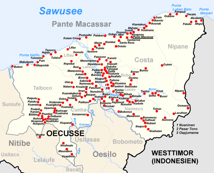
Deutsch: Subdistrikt Pante Macassar, Distrikt Oecusse, Osttimor English: Subdistrict of Pante Macassar, district Oecusse, East Timor |
| Petsa | (UTC) |
| Ginkuhaan | |
| Awtor |
| This is a retouched picture, which means that it has been digitally altered from its original version. Modifications: Adminitrative names, cities and rivers Pante Macassar of Nitibe added. The original can be viewed here: Administrative map of the Oecussi district of East Timor.png:
|
I, the copyright holder of this work, hereby publish it under the following license:
This file is licensed under the Creative Commons Attribution-Share Alike 2.5 Generic license.
- Talwas ka:
- para han pagpasaro – para han pagkopya, pagpakalat ngan pagpadangat han buhat
- para han pagremix – pag-adapt han buhat
- Ha ilarom an masunod nga mga kondisyon:
- attribution – Kinahanglanon mo tagan hin kaangayan nga credit, paghatag hin sumpay ngadto ha lisensya, ngan igbutang an imo ginbag-ohan nga binuhat. Puydi mo ini buhaton ha bisan ano nga resonable nga pamaagi, pero diri nimo pagawson nga an naghatag hin lisensya nag-eendorso ha imo o ha imo paggamit.
- share alike – Kun imo ginsagol-hin-otro, gin-iba, o gin-hingayad han buhat, ikaw in angay gud là magpakalat han imo gin-amot ha ilarom la han [http:creativecommons.org/share-your-work/licensing-considerations/compatible-licenses pareho o naangay nga lisensya] sugad han orihinal.
Original upload log
This image is a derivative work of the following images:
- File:Administrative_map_of_the_Oecussi_district_of_East_Timor.png licensed with Cc-by-sa-2.5
- 2010-06-03T07:46:45Z Chumwa 1855x1345 (152369 Bytes) Fatu Sinai wieder mit in den Kartenausschnitt aufgenommen
- 2010-06-03T07:39:20Z Chumwa 1702x1345 (155027 Bytes) Flüsse hinzugefügt
- 2009-09-22T05:16:22Z Chumwa 1861x1345 (115296 Bytes) Fatu Sinai mit in den Kartenausschnitt aufgenommen
- 2009-09-19T05:59:03Z Chumwa 1702x1345 (110884 Bytes) {{Information |Description= {{ de }} Verwaltungskarte des Distrikts Oecussi in Osttimor {{ en }} Administrative map of the Oecussi district of East Timor |Source=Self made, using informations from the[http://websig.civil.ist.
Uploaded with derivativeFX
Kaagi han paypay
Pidlita an adlaw/oras para makit-an an fayl nga naggawas hito nga oras.
| Pitsa/Oras | Thumbnail | Mga dimensyon | Gumaramit | Komento | |
|---|---|---|---|---|---|
| waray pa kasasapawi | 10:43, 6 Hulyo 2010 | | 1,008 × 816 (296 nga KB) | J. Patrick Fischer | {{Information |Description={{ de }} Subdistrikt Pante Macassar, Distrikt Oecusse, Osttimor {{ en }} Subdistrict of Pante Macassar, district Oecusse, East Timor |Source=*File:Administrative_map_of_the_Oecussi_district_of_East_Timor.png |Date=2010-07 |
Mga Sumpay
An mga nasunod nga mga pakli nasumpay hini nga paypay:
Global file usage
An masunod nga iba nga mga wiki in nagamit hini nga file:
- Paggamit ha de.wikipedia.org
- Paggamit ha en.wikipedia.org
- Paggamit ha es.wikipedia.org
- Paggamit ha id.wikipedia.org
- Paggamit ha it.wikipedia.org
- Paggamit ha ja.wikipedia.org
- Paggamit ha ms.wikipedia.org
- Paggamit ha nl.wikipedia.org
- Paggamit ha no.wikipedia.org
- Paggamit ha pl.wikipedia.org
- Paggamit ha pt.wikipedia.org
- Paggamit ha sv.wikipedia.org
- Paggamit ha tet.wikipedia.org
- Paggamit ha ur.wikipedia.org
- Paggamit ha www.wikidata.org