
Paypay:Pays de la Loire region relief location map.jpg

Kadako hin nga pahiuna nga pagawas: 619 × 599 nga mga pixel. Iba nga mga resolusyon: 248 × 240 nga mga pixel | 496 × 480 nga mga pixel | 793 × 768 nga mga pixel | 1,058 × 1,024 nga mga pixel | 1,546 × 1,497 nga mga pixel.
Orihinal nga paypay (1,546 × 1,497 nga pixel, kadako han fayl: 395 nga KB, MIME nga tipo: image/jpeg)
Dalikyat nga pulong
| Tigtulidong |
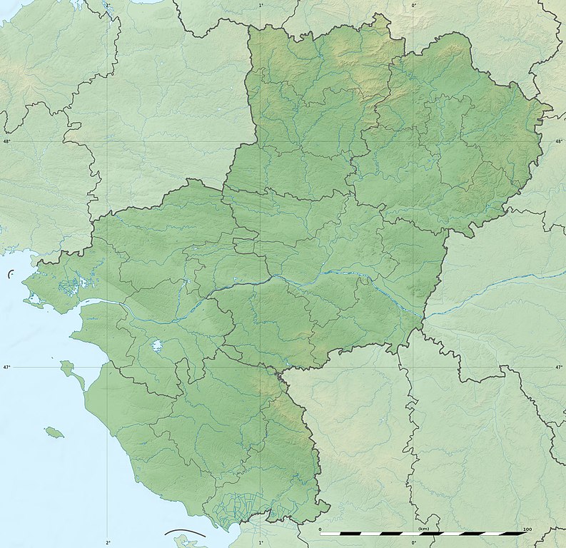
English: Blank physical map of the region of Pays de la Loire, France, as in February 2011, for geo-location purpose, with distinct boundaries for regions, departments and arrondissements.
Français : Carte physique vierge de la région des Pays de la Loire, France, telle qu'en février 2011, destinée à la géolocalisation, avec limite distincte des régions, départements et arrondissements. Scales:
Equirectangular projection, WGS84 datum
Geographic limits of the map:
|
||
| Petsa | |||
| Ginkuhaan |
Kalugaringon nga buhat
|
||
| Awtor | Eric Gaba (Sting - fr:Sting) | ||
| Pagtugot (Gin-uutro paggamit inin nga file) |
|
||
| Other versions |
|

| Camera location | | View this and other nearby images on: OpenStreetMap |
|---|
Palilisensya:
Eric Gaba, Wikimedia Commons user Sting, the copyright holder of this work, hereby publishes it under the following license:
Ini nga file in nakalisensya ha ilarom han Creative Commons Attribution-Share Alike 3.0 Unported license.
Attribution: Eric Gaba, Wikimedia Commons user Sting
- Talwas ka:
- para han pagpasaro – para han pagkopya, pagpakalat ngan pagpadangat han buhat
- para han pagremix – pag-adapt han buhat
- Ha ilarom an masunod nga mga kondisyon:
- attribution – Kinahanglanon mo tagan hin kaangayan nga credit, paghatag hin sumpay ngadto ha lisensya, ngan igbutang an imo ginbag-ohan nga binuhat. Puydi mo ini buhaton ha bisan ano nga resonable nga pamaagi, pero diri nimo pagawson nga an naghatag hin lisensya nag-eendorso ha imo o ha imo paggamit.
- share alike – Kun imo ginsagol-hin-otro, gin-iba, o gin-hingayad han buhat, ikaw in angay gud là magpakalat han imo gin-amot ha ilarom la han [http:creativecommons.org/share-your-work/licensing-considerations/compatible-licenses pareho o naangay nga lisensya] sugad han orihinal.
Kaagi han paypay
Pidlita an adlaw/oras para makit-an an fayl nga naggawas hito nga oras.
| Pitsa/Oras | Thumbnail | Mga dimensyon | Gumaramit | Komento | |
|---|---|---|---|---|---|
| waray pa kasasapawi | 18:16, 2 Marso 2011 | | 1,546 × 1,497 (395 nga KB) | Sting | Missing shaded relief on sea area |
| 13:47, 2 Marso 2011 |  | 1,546 × 1,497 (438 nga KB) | Sting | == {{int:filedesc}} == {{Information |Description={{en|Blank physical map of the region of Pays de la Loire, France, as in February 2011, for geo-location purpose, with distinct boundaries for regions, departments and arrondisseme |
Mga Sumpay
An mga nasunod nga mga pakli nasumpay hini nga paypay:
Global file usage
An masunod nga iba nga mga wiki in nagamit hini nga file:
- Paggamit ha als.wikipedia.org
- Paggamit ha ar.wikipedia.org
- Paggamit ha bg.wikipedia.org
- Paggamit ha bn.wikipedia.org
- Paggamit ha ceb.wikipedia.org
- Paggamit ha cy.wikipedia.org
- Paggamit ha de.wikipedia.org
- Paggamit ha el.wikipedia.org
- Paggamit ha en.wikipedia.org
- Maine (river)
- Ernée (river)
- Thouet
- Lac d'Apremont
- Èvre
- Vègre
- Layon
- Oudon (river)
- Vaige
- Verzée
- Yon (river)
- Smagne
- Chère
- Petite Maine
- Boulogne (river)
- User:Michael!/Project:Location map templates/France
- Grand-Auverné Formation
- Vie (river)
- Module:Location map/data/France Pays de la Loire
- Module:Location map/data/France Pays de la Loire/doc
- User:DutchTreat/Projects/Places
- Bay of Bourgneuf
- Acheneau
- 1799 Vendée earthquake
- Canal de Haute Perche
- Authion
- Blanche (Loire-Atlantique)
Kitaa durudamo nga global usage hinin nga file.