
Paypay:Puerto Rico barrios.png

Kadako hin nga pahiuna nga pagawas: 800 × 513 nga mga pixel. Iba nga mga resolusyon: 320 × 205 nga mga pixel | 640 × 411 nga mga pixel | 1,024 × 657 nga mga pixel | 1,280 × 821 nga mga pixel | 1,601 × 1,027 nga mga pixel.
Orihinal nga paypay (1,601 × 1,027 nga pixel, kadako han fayl: 56 nga KB, MIME nga tipo: image/png)
Dalikyat nga pulong
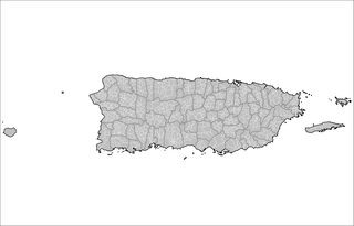
| Tigtulidong | Map of the barrios (wards/districts) of Puerto Rico. Created by Rarelibra 15:34, 19 December 2007 (UTC) for public domain use, using MapInfo Professional and various mapping resources. |
| Petsa | 19 Disyembre 2007 (original upload date) |
| Ginkuhaan | No machine-readable source provided. Own work assumed (based on copyright claims). |
| Awtor | No machine-readable author provided. Rarelibra assumed (based on copyright claims). |
Palilisensya:
| I, the copyright holder of this work, release this work into the public domain. This applies worldwide. In some countries this may not be legally possible; if so: I grant anyone the right to use this work for any purpose, without any conditions, unless such conditions are required by law. |
derivative works
Derivative works of this file: Municipios pr.svg
Kaagi han paypay
Pidlita an adlaw/oras para makit-an an fayl nga naggawas hito nga oras.
| Pitsa/Oras | Thumbnail | Mga dimensyon | Gumaramit | Komento | |
|---|---|---|---|---|---|
| waray pa kasasapawi | 15:34, 19 Disyembre 2007 | | 1,601 × 1,027 (56 nga KB) | Rarelibra | Map of the barrios (wards/districts) of Puerto Rico. Created by ~~~~ for public domain use, using MapInfo Professional and various mapping resources. |
Mga Sumpay
An mga nasunod nga mga pakli nasumpay hini nga paypay:
Global file usage
An masunod nga iba nga mga wiki in nagamit hini nga file:
- Paggamit ha br.wikipedia.org
- Paggamit ha ceb.wikipedia.org
- Paggamit ha es.wikipedia.org
- Paggamit ha it.wikipedia.org