
Paypay:Spain Galicia location map.svg

Size of this PNG preview of this SVG file: 512 × 553 nga mga pixel. Iba nga mga resolusyon: 222 × 240 nga mga pixel | 444 × 480 nga mga pixel | 711 × 768 nga mga pixel | 948 × 1,024 nga mga pixel | 1,896 × 2,048 nga mga pixel.
Orihinal nga paypay (SVG nga fayl, ginbabanabanahan nga 512 × 553 nga mga pixel, kadako han fayl: 576 nga KB)
Dalikyat nga pulong
| Tigtulidong |
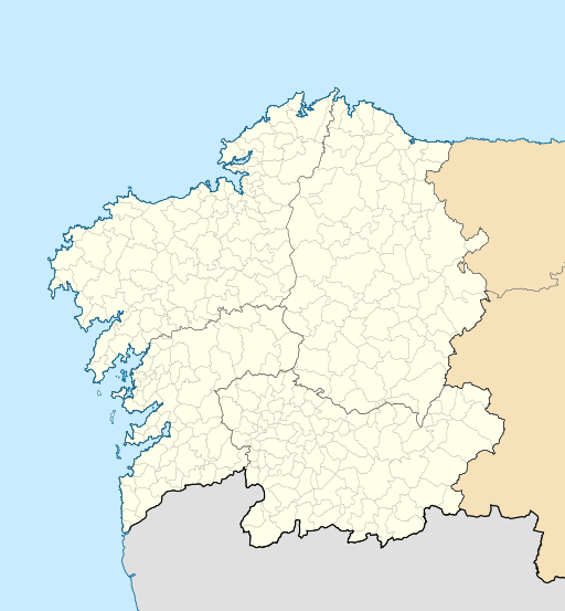
English: Location map of Galicia (Spain)
Equirectangular projection, N/S stretching 130 %. Geographic limits of the map:
Español: Mapa de localización de la comunidad autónoma de Galicia (España)
Proyección equirrectangular, N/S estirada 130 %. Límites geográficos del mapa:
|
|
| Petsa | ||
| Ginkuhaan | Own work based on: EspañaLoc.svg by HansenBCN | |
| Awtor | Miguillen | |
| SVG genesis | This locator map was created with Inkscape.
|
Palilisensya:
Miguillen, the copyright holder of this work, hereby publishes it under the following license:
Ini nga file in nakalisensya ha ilarom han Creative Commons Attribution-Share Alike 3.0 Unported license.
Attribution: Miguillen
- Talwas ka:
- para han pagpasaro – para han pagkopya, pagpakalat ngan pagpadangat han buhat
- para han pagremix – pag-adapt han buhat
- Ha ilarom an masunod nga mga kondisyon:
- attribution – Kinahanglanon mo tagan hin kaangayan nga credit, paghatag hin sumpay ngadto ha lisensya, ngan igbutang an imo ginbag-ohan nga binuhat. Puydi mo ini buhaton ha bisan ano nga resonable nga pamaagi, pero diri nimo pagawson nga an naghatag hin lisensya nag-eendorso ha imo o ha imo paggamit.
- share alike – Kun imo ginsagol-hin-otro, gin-iba, o gin-hingayad han buhat, ikaw in angay gud là magpakalat han imo gin-amot ha ilarom la han [http:creativecommons.org/share-your-work/licensing-considerations/compatible-licenses pareho o naangay nga lisensya] sugad han orihinal.
Kaagi han paypay
Pidlita an adlaw/oras para makit-an an fayl nga naggawas hito nga oras.
| Pitsa/Oras | Thumbnail | Mga dimensyon | Gumaramit | Komento | |
|---|---|---|---|---|---|
| waray pa kasasapawi | 21:49, 19 Oktubre 2016 | | 512 × 553 (576 nga KB) | HombreDHojalata | [http://www.xunta.es/dog/Publicados/2013/20130607/AnuncioG0244-060613-0003_gl.html DECRETO 83/2013, do 6 de xuño, polo que se aproba a fusión voluntaria dos municipios de Oza dos Ríos e Cesuras e se constitúe o municipio de Oza-Cesuras] DOG, 7 de x... |
| 21:33, 19 Oktubre 2016 |  | 512 × 553 (576 nga KB) | HombreDHojalata | [http://www.xunta.gal/dog/Publicados/2016/20161017/AnuncioG0244-131016-0001_gl.html DECRETO 134/2016, do 22 de setembro, polo que se aproba a fusión voluntaria dos municipios de Cerdedo e Cotobade e se constitúe o municipio de Cerdedo-Cotobade], DOG... | |
| 18:32, 20 Mayo 2010 |  | 512 × 553 (551 nga KB) | Miguillen | color mar | |
| 15:28, 20 Mayo 2010 |  | 512 × 553 (551 nga KB) | Miguillen | == {{int:filedesc}} == {{Information |Description={{en|Location map of Galicia (Spain)}} Equirectangular projection, N/S stretching 130 %. Geographic limits of the map: * N: 43.055249° N * S: 39.750129° N * W: 2.282836° O * E: 0. |
Mga Sumpay
An mga nasunod nga mga pakli nasumpay hini nga paypay:
Global file usage
An masunod nga iba nga mga wiki in nagamit hini nga file:
- Paggamit ha ar.wikipedia.org
- Paggamit ha ast.wikipedia.org
- Paggamit ha az.wikipedia.org
- Paggamit ha ba.wikipedia.org
- Paggamit ha be.wikipedia.org
- Paggamit ha bg.wikipedia.org
- Paggamit ha ca.wikipedia.org
- Paggamit ha ceb.wikipedia.org
- Paggamit ha cs.wikipedia.org
- Paggamit ha de.wikipedia.org
Kitaa durudamo nga global usage hinin nga file.