
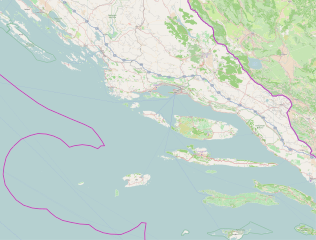
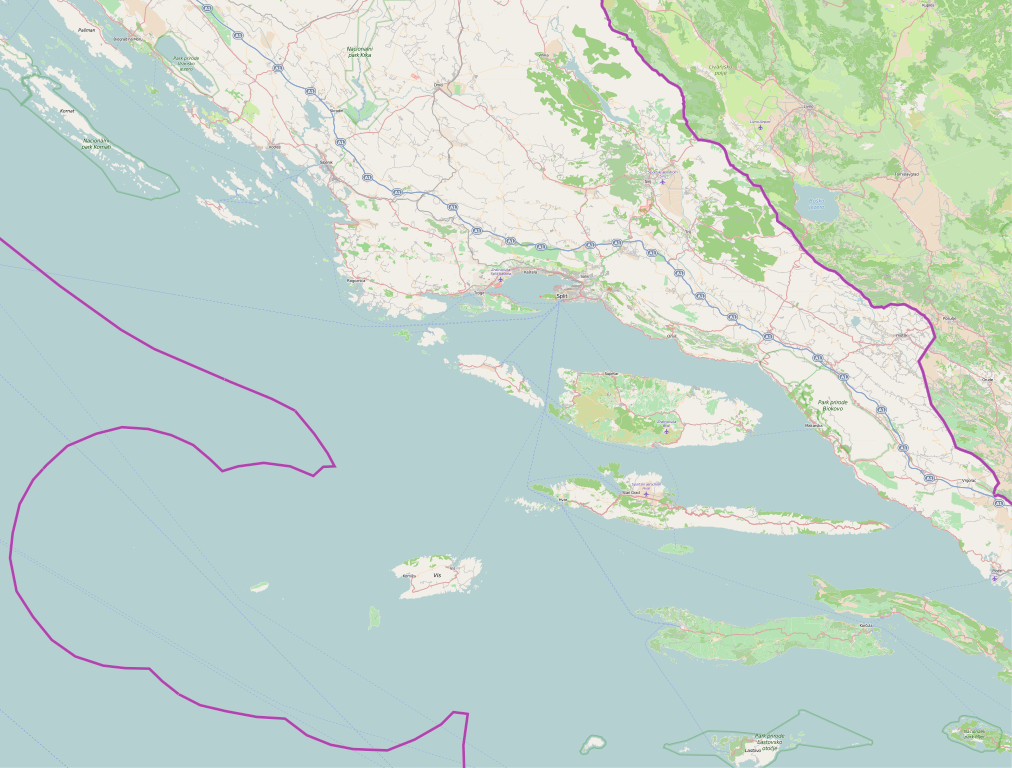
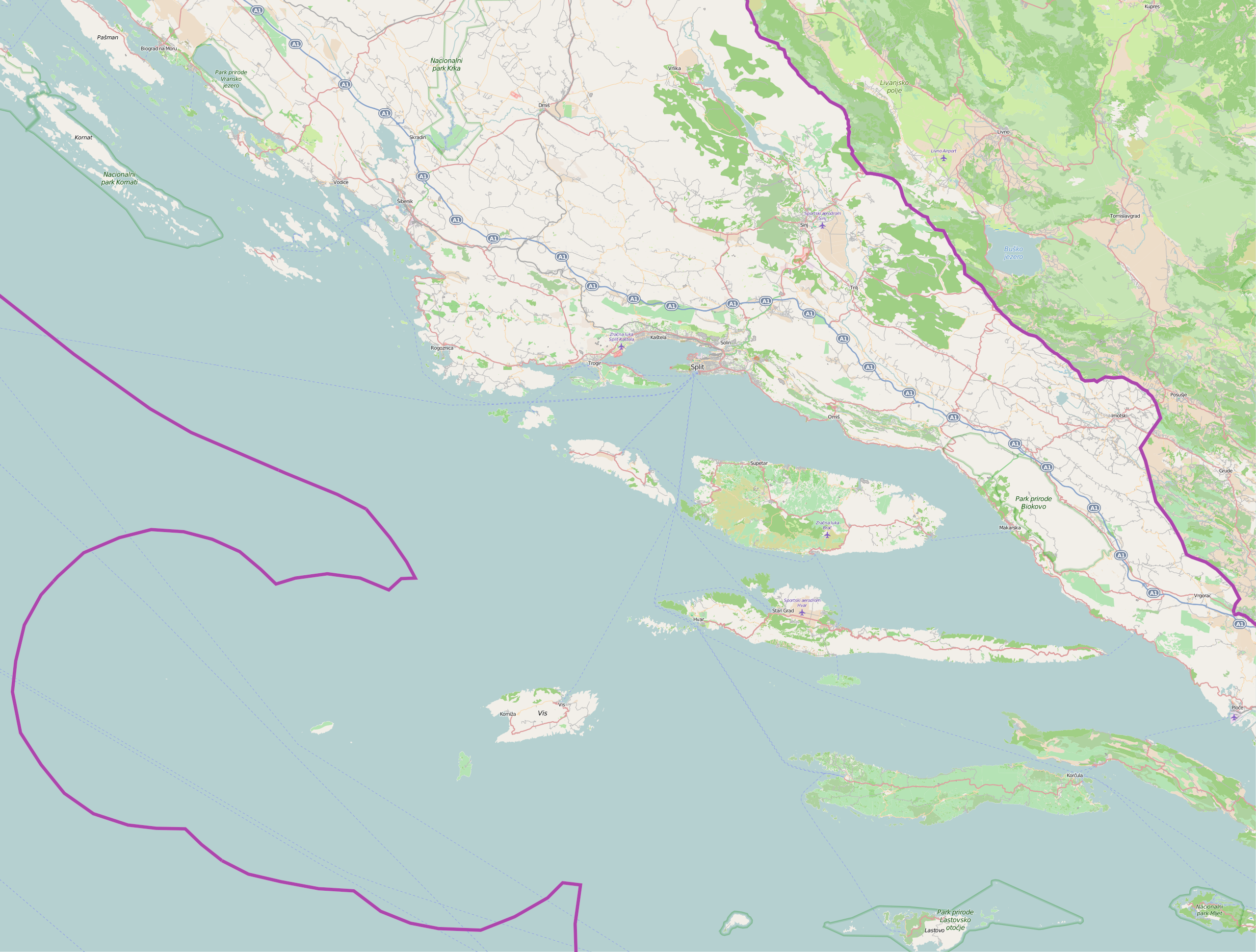
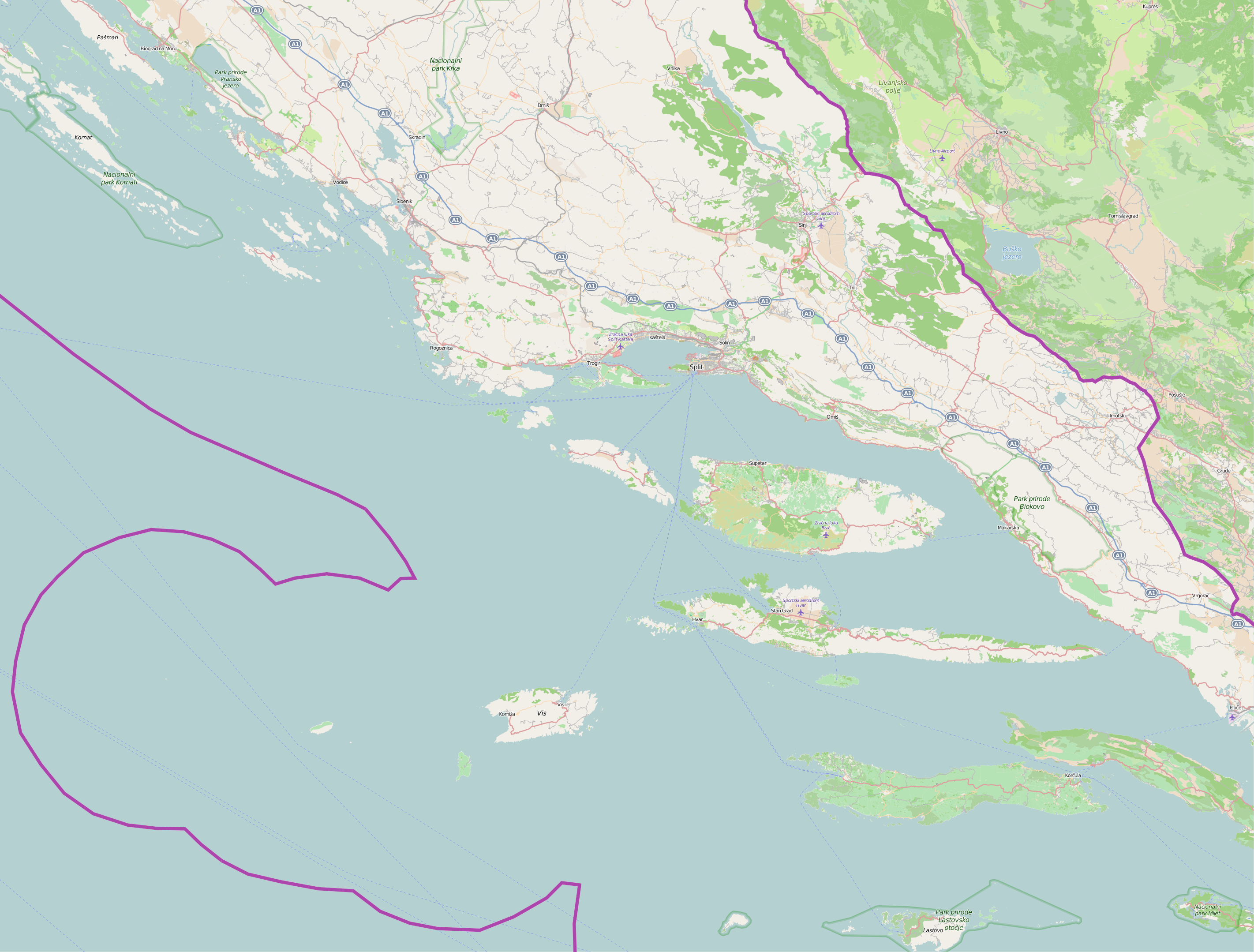
Paypay:Split-Dalmatia County OpenStreetMap.svg

Size of this PNG preview of this SVG file: 790 × 600 nga mga pixel. Iba nga mga resolusyon: 316 × 240 nga mga pixel | 633 × 480 nga mga pixel | 1,012 × 768 nga mga pixel | 1,280 × 972 nga mga pixel | 2,560 × 1,943 nga mga pixel | 2,843 × 2,158 nga mga pixel.
Orihinal nga paypay (SVG nga fayl, ginbabanabanahan nga 2,843 × 2,158 nga mga pixel, kadako han fayl: 45.36 nga MB)
| Description |
This map of Splitsko-dalmatinska županija was created from OpenStreetMap project data, collected by the community. This map may be incomplete, and may contain errors. Don't rely solely on it for navigation. |
| Petsa | (see file history) |
| Ginkuhaan | openstreetmap.org |
| Creator |
OpenStreetMap contributors |
| Pagtugot (Gin-uutro paggamit inin nga file) |
OpenStreetMap data and maps are licensed under the Creative Commons Attribution-ShareAlike 2.0 license (CC-BY-SA 2.0). This file is licensed under the Creative Commons Attribution-Share Alike 2.0 Generic license.
|
| Georeferencing | If inappropriate please set warp_status = skip to hide. |
Kaagi han paypay
Pidlita an adlaw/oras para makit-an an fayl nga naggawas hito nga oras.
| Pitsa/Oras | Thumbnail | Mga dimensyon | Gumaramit | Komento | |
|---|---|---|---|---|---|
| waray pa kasasapawi | 07:18, 22 Hulyo 2015 | | 2,843 × 2,158 (45.36 nga MB) | Vedran V | An new, updated and larger version of map |
| 07:15, 22 Hulyo 2015 |  | 1,431 × 1,086 (11.62 nga MB) | Vedran V | An updated version of map | |
| 18:48, 8 Marso 2010 |  | 1,325 × 998 (1.59 nga MB) | Ex13 | {{OpenStreetMap|location=Splitsko-dalmatinska županija}} Category:Split-Dalmatia County Category:Maps of counties of Croatia |
Mga Sumpay
An mga nasunod nga mga pakli nasumpay hini nga paypay:
Global file usage
An masunod nga iba nga mga wiki in nagamit hini nga file:
- Paggamit ha ar.wikipedia.org
- Paggamit ha bs.wikipedia.org
- Paggamit ha ceb.wikipedia.org
- Paggamit ha en.wikipedia.org
- Paggamit ha es.wikipedia.org
- Paggamit ha fa.wikipedia.org
- Paggamit ha hr.wikipedia.org
- Barbarinac
- Jadro
- Biševo
- Sveta Fumija (otok)
- Sušac
- Murvica (otok)
- Splitsko-dalmatinska županija
- Zlatni rat
- Zračna luka Brač
- Zračna luka Sveti Jeronim
- Mlaska
- Perna (uvala)
- Mrtinovik
- Česminica
- Lukvenjak
- Orud
- Plaža Grebišće
- Pokrivenik
- Ruda (rijeka)
- Krunidbena crkva sv. Petra i Mojsija
- Vojskova (Cetina)
- Mulo (hrid)
- Požari u Hrvatskoj 2017.
- Crkva sv. Petra na Kamenu i arheološko nalazište
- Svjetionik Hrid Mulo
- Svjetionik Otočić Murvica
Kitaa durudamo nga global usage hinin nga file.