
Paypay:Sweden Västmanland location map.svg

Size of this PNG preview of this SVG file: 452 × 599 nga mga pixel. Iba nga mga resolusyon: 181 × 240 nga mga pixel | 362 × 480 nga mga pixel | 579 × 768 nga mga pixel | 772 × 1,024 nga mga pixel | 1,545 × 2,048 nga mga pixel | 654 × 867 nga mga pixel.
Orihinal nga paypay (SVG nga fayl, ginbabanabanahan nga 654 × 867 nga mga pixel, kadako han fayl: 116 nga KB)
Dalikyat nga pulong
| Tigtulidong |
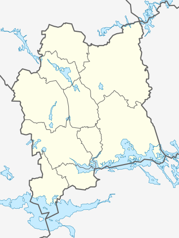
English: Location map of Västmanland in Sweden
Equirectangular projection, N/S stretching 199 %. Geographic limits of the map:
Deutsch: Positionskarte von Västmanland in Schweden
Quadratische Plattkarte, N-S-Streckung 199 %. Geographische Begrenzung der Karte:
|
| Petsa | |
| Ginkuhaan | Kalugaringon nga buhat |
| Awtor | Erik Frohne |
Palilisensya:
I, the copyright holder of this work, hereby publish it under the following licenses:

|
An permiso in ginhatag ha pagkopya, pagpakalat ngan/o pagliwat hinin nga dokumento ha ilarom han mga termino han GNU Free Documentation License, Version 1.2 o mas uruurhi nga version nga ginmantala han Free Software Foundation; nga may-ada waray Invariant Sections, waray Front-Cover Texts, ngan waray Back-Cover Texts. May-ada kopya hin lisensya nga ginlalakip ha seksyon nga may-ada pamagat nga GNU Free Documentation License. |
This file is licensed under the Creative Commons Attribution 3.0 Unported license.
- Talwas ka:
- para han pagpasaro – para han pagkopya, pagpakalat ngan pagpadangat han buhat
- para han pagremix – pag-adapt han buhat
- Ha ilarom an masunod nga mga kondisyon:
- attribution – Kinahanglanon mo tagan hin kaangayan nga credit, paghatag hin sumpay ngadto ha lisensya, ngan igbutang an imo ginbag-ohan nga binuhat. Puydi mo ini buhaton ha bisan ano nga resonable nga pamaagi, pero diri nimo pagawson nga an naghatag hin lisensya nag-eendorso ha imo o ha imo paggamit.
Puydi ka pumili hin lisenysa nga karuyag mo.
Kaagi han paypay
Pidlita an adlaw/oras para makit-an an fayl nga naggawas hito nga oras.
| Pitsa/Oras | Thumbnail | Mga dimensyon | Gumaramit | Komento | |
|---|---|---|---|---|---|
| waray pa kasasapawi | 13:41, 2 Pebrero 2009 | | 654 × 867 (116 nga KB) | Erik Frohne | {{Information |Description={{en|1=Location map of Västmanland in Sweden Equirectangular projection, N/S stretching 199 %. Geographic limits of the map: * N: 60.30° N * S: 59.10° N * W: 15.30° E * E: 17.10° E}} {{de|1=Positionskarte von Västmanland |
Mga Sumpay
An mga nasunod nga mga pakli nasumpay hini nga paypay:
Global file usage
An masunod nga iba nga mga wiki in nagamit hini nga file:
- Paggamit ha ar.wikipedia.org
- Paggamit ha bg.wikipedia.org
- Paggamit ha ceb.wikipedia.org
- Paggamit ha da.wikipedia.org
- Paggamit ha de.wikipedia.org
- Västerås
- Fagersta
- Strömsholm
- Hallstahammar
- Arboga
- Sala (Schweden)
- Surahammar
- Arosvallen
- Kungsör
- Köping (Ort)
- Skinnskatteberg
- Flughafen Stockholm-Västerås
- Wikipedia:Kartenwerkstatt/Positionskarten/Europa
- Vorlage:Positionskarte Schweden Västmanland
- Uttersberg
- Hitachi Energy Arena
- Flugplatz Arboga
- Norberg (Ort)
- Ängelsberg
- Riddarhyttan
- Valskog
- Västerås Arena
- Division 1 (Schweden) 2012
- Munktorps-Ekeby
- Flugplatz Salanda
- ABB Arena
- Paggamit ha en.wikipedia.org
Kitaa durudamo nga global usage hinin nga file.