
Paypay:USA Guam satellite image location map.jpg

Kadako hin nga pahiuna nga pagawas: 600 × 600 nga mga pixel. Iba nga mga resolusyon: 240 × 240 nga mga pixel | 480 × 480 nga mga pixel | 768 × 768 nga mga pixel | 1,200 × 1,200 nga mga pixel.
Orihinal nga paypay (1,200 × 1,200 nga pixel, kadako han fayl: 540 nga KB, MIME nga tipo: image/jpeg)
Dalikyat nga pulong
| Tigtulidong |
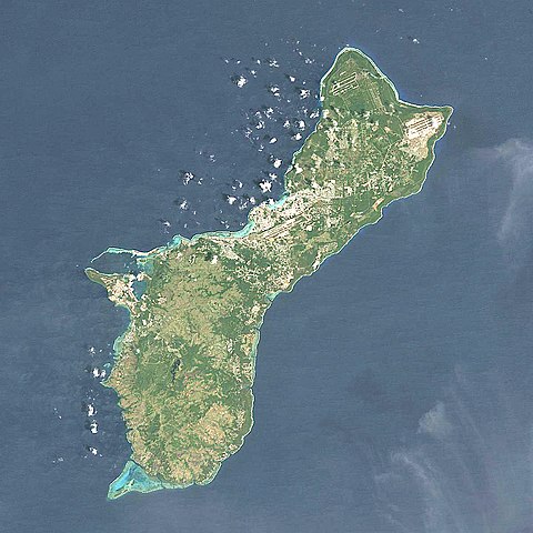
Quadratische Plattkarte, N-S-Streckung 100.0 %. Geographische Begrenzung der Karte: Equirectangular projection, N/S stretching 100.0 %. Geographic limits of the map:
|
| Petsa | |
| Ginkuhaan | NASA, Landsat7 visual, http://onearth.jpl.nasa.gov |
| Awtor | Alexrk2 |
| Other versions |
|


|
This map has been made or improved in the German Kartenwerkstatt (Map Lab). You can propose maps to improve as well.
|
Palilisensya:
I, the copyright holder of this work, hereby publish it under the following license:
Ini nga file in nakalisensya ha ilarom han Creative Commons Attribution-Share Alike 3.0 Unported license.
- Talwas ka:
- para han pagpasaro – para han pagkopya, pagpakalat ngan pagpadangat han buhat
- para han pagremix – pag-adapt han buhat
- Ha ilarom an masunod nga mga kondisyon:
- attribution – Kinahanglanon mo tagan hin kaangayan nga credit, paghatag hin sumpay ngadto ha lisensya, ngan igbutang an imo ginbag-ohan nga binuhat. Puydi mo ini buhaton ha bisan ano nga resonable nga pamaagi, pero diri nimo pagawson nga an naghatag hin lisensya nag-eendorso ha imo o ha imo paggamit.
- share alike – Kun imo ginsagol-hin-otro, gin-iba, o gin-hingayad han buhat, ikaw in angay gud là magpakalat han imo gin-amot ha ilarom la han [http:creativecommons.org/share-your-work/licensing-considerations/compatible-licenses pareho o naangay nga lisensya] sugad han orihinal.
Kaagi han paypay
Pidlita an adlaw/oras para makit-an an fayl nga naggawas hito nga oras.
| Pitsa/Oras | Thumbnail | Mga dimensyon | Gumaramit | Komento | |
|---|---|---|---|---|---|
| waray pa kasasapawi | 17:05, 14 Marso 2010 | | 1,200 × 1,200 (540 nga KB) | Alexrk2 | == Beschreibung == {{Information |Description= {{de|Satellitenfoto von Guam, USA}} Quadratische Plattkarte, N-S-Streckung 100.0 %. Geographische Begrenzung der Karte: {{en|Satellite Image of Guam, USA}} Eq |
Mga Sumpay
An mga nasunod nga mga pakli nasumpay hini nga paypay:
Global file usage
An masunod nga iba nga mga wiki in nagamit hini nga file:
- Paggamit ha af.wikipedia.org
- Paggamit ha ar.wikipedia.org
- Paggamit ha ast.wikipedia.org
- Paggamit ha az.wikipedia.org
- Paggamit ha bcl.wikipedia.org
- Paggamit ha be.wikipedia.org
- Paggamit ha bg.wikipedia.org
- Paggamit ha ceb.wikipedia.org
- Paggamit ha ce.wikipedia.org
- Paggamit ha cs.wikipedia.org
- Paggamit ha da.wikipedia.org
- Paggamit ha de.wikipedia.org
- Paggamit ha de.wikivoyage.org
- Paggamit ha en.wikipedia.org
- War in the Pacific National Historical Park
- Mount Lamlam
- Mount Jumullong Manglo
- Mount Alifan
- Talofofo Bay
- Fena Lake
- Cocos Lagoon
- Module:Location map/data/USA Guam/doc
- Pago River
- Talofofo River
- Agat Bay
- Agaga River
- Agfayan River
- Aguada River
- Ajayan River
- Alatgue River
- Almagosa River
- Aplacho River
- Asalonso River
- Aslinget River
- Asmafines River
- Astaban River
- Atantano River
- Atate River
- Big Guatali River
- Bile River
- Bolanos River
- Bonya River
- Bubulao River
- Cetti River
- Chagame River
- Chaot River
- Dante River
Kitaa durudamo nga global usage hinin nga file.